Area Overview for B65 8NW
Photos of B65 8NW
Area Information
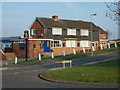
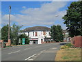
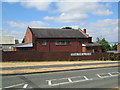
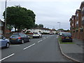
Living in B65 8NW means being part of a small, tightly knit residential cluster in the Rowley Regis area of Sandwell, West Midlands. With a population of 2,153, this postcode reflects a community rooted in historical transitions from rural to industrial landscapes. The area’s character is shaped by its proximity to St Giles Church, a site of Saxon heritage, and its role as part of the Rowley Ward electoral district. Daily life here balances practicality with accessibility, with residents benefiting from nearby rail links to Birmingham and surrounding towns. The area’s mix of houses and modest home ownership rates (44%) suggests a blend of long-term residents and those seeking stable living. While it lacks the density of larger urban centres, B65 8NW offers a quiet, manageable environment with essential services within reach. Its small size means the community feels cohesive, with shared spaces and local amenities contributing to a distinct local identity.
- Area Type
- Postcode
- Area Size
- Not available
- Population
- 2153
- Population Density
- 4010 people/km²
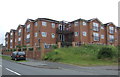
The property market in B65 8NW is characterised by a 44% home ownership rate, with houses forming the primary accommodation type. This indicates a community where owner-occupation is common but not dominant, leaving a significant portion of the housing stock available for rental. The prevalence of houses suggests a focus on family homes, which may appeal to buyers seeking space and privacy. Given the small size of the area, property options are likely limited to a few key locations, with immediate surroundings offering similar stock. Buyers should consider the balance between home ownership and rental availability, as well as the practicality of living in a low-density, residential cluster. The housing stock’s composition may also influence local property values and demand.
House Prices in B65 8NW
No properties found in this postcode.
Energy Efficiency in B65 8NW
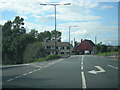
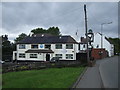
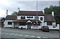
The lifestyle in B65 8NW is defined by practical accessibility to shops, transport, and local services. Within practical reach are five retail venues, including Spar Rowley, Tesco Rowley, and Lidl Netherton, offering everyday essentials. The presence of multiple rail and metro stations ensures easy access to urban hubs, while the area’s historical roots provide a quiet, community-focused atmosphere. Though not a sprawling commercial district, the cluster of amenities supports a convenient, low-maintenance lifestyle. The mix of retail options and transport links means residents can meet daily needs without long commutes, fostering a sense of self-sufficiency within the local environment.
Amenities
Schools
The nearest school to B65 8NW is Brickhouse Primary School, which holds a ‘good’ Ofsted rating. This institution serves the local community, providing education for younger children in a setting that meets national standards. The absence of secondary schools in the immediate vicinity means families may need to look beyond the postcode for comprehensive schooling. However, the presence of a well-rated primary school is a positive factor for families with young children, offering a reliable foundation for early education. The school’s rating reflects a commitment to quality teaching and facilities, which can be a decisive factor for prospective homebuyers prioritising educational opportunities.
| Rank | School | Type | Entry gender | Ages |
|---|---|---|---|---|
| 1 | Brickhouse Primary School | primary | N/A | N/A |
Explore more schools in this area
Go to Schools tabDemographics
The population of B65 8NW has a median age of 47, with the majority of residents falling within the 30–64 age range. This suggests a mature, stable community with a focus on established households. Home ownership stands at 44%, indicating a mix of owner-occupied properties and rental units. The accommodation type is predominantly houses, reflecting a preference for family-friendly living spaces. The predominant ethnic group is White, though specific data on diversity or deprivation is not available. The age profile and housing stock suggest a community prioritising stability over transient lifestyles. With no explicit data on income or deprivation, it is reasonable to infer that the area supports a moderate quality of life, though further localised analysis would be needed to confirm this.
Household Size
Accommodation Type
Tenure
Ethnic Group
Religion
Household Composition
Age
Household Deprivation
NS-SEC
Explore more demographic insights in this area
Go to Demographics tabPlanning
Planning Constraints
- Flood RiskPremium
- Ramsar Wetland SitesPremium
- Area of Outstanding Natural BeautyPremium
- Protected Nature ReservePremium
- Protected WoodlandPremium
- Crime RiskPremium