Area Overview for B65 8JE
Photos of B65 8JE
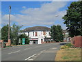
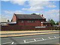
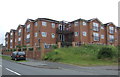
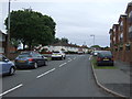
20 photos from this area
Area Information
Key information about the B65 8JE including its size, population, and administrative classification.
- Area Type
- Postcode
- Area Size
- 9148 m²
- Population
- 1544
- Population Density
- 3752 people/km²
House Prices in B65 8JE
24
Properties
£200,643
Average Sold Price
£90,500
Lowest Price
£292,500
Highest Price
Showing 24 properties
| Address | Type | Beds | Baths | Last Sale Price | Last Sale Date | |
|---|---|---|---|---|---|---|
| 39 Doulton Road, Rowley Regis, B65 8JE | Semi-detached | 3 | 1 | £208,000 | Mar 2025 | |
| 66 Doulton Road, Rowley Regis, B65 8JE | house | 3 | 2 | £292,500 | Feb 2024 | |
| 68 Doulton Road, Rowley Regis, B65 8JE | house | 3 | - | £278,500 | Jul 2022 | |
| 45 Doulton Road, Rowley Regis, B65 8JE | house | - | - | £140,000 | Feb 2021 | |
| 70 Doulton Road, Rowley Regis, B65 8JE | Detached | 4 | 2 | £270,000 | Feb 2019 | |
| 35 Doulton Road, Rowley Regis, B65 8JE | Semi-detached | 4 | 1 | £125,000 | Feb 2016 | |
| 57 Doulton Road, Rowley Regis, B65 8JE | Detached | 3 | 1 | £90,500 | Jul 2013 | |
| 49 Doulton Road, Rowley Regis, B65 8JE | Detached | 3 | 1 | - | - | |
| 47 Doulton Road, Rowley Regis, B65 8JE | Semi-detached | 3 | 1 | - | - | |
| 53 Doulton Road, Rowley Regis, B65 8JE | Semi-detached | 3 | 1 | - | - |
Page 1 of 3
Energy Efficiency in B65 8JE
Amenities
Schools
| Rank | School | Type | Entry gender | Ages |
|---|
Explore more schools in this area
Go to Schools tabDemographics
Household Size
Family (3-5 people)
most common
Accommodation Type
Houses
most common
Tenure
57
majority
Ethnic Group
White
most common
Religion
N/A
most common
Household Composition
N/A
most common
Age
47
median
Adults (30-64 years)
most common
Household Deprivation
N/A
with no deprivation
NS-SEC
21
in Lower managerial occupations
Explore more demographic insights in this area
Go to Demographics tabPlanning
Planning Constraints
- Flood RiskPremium
- Ramsar Wetland SitesPremium
- Area of Outstanding Natural BeautyPremium
- Protected Nature ReservePremium
- Protected WoodlandPremium