Area Overview for B65 8HL
Photos of B65 8HL
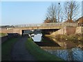
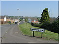
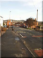
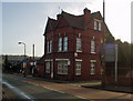
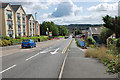
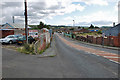
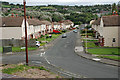
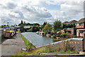
63 photos from this area
Area Information
Key information about the B65 8HL including its size, population, and administrative classification.
- Area Type
- Postcode
- Area Size
- 3.8 hectares
- Population
- 2153
- Population Density
- 4010 people/km²
House Prices in B65 8HL
30
Properties
£118,857
Average Sold Price
£42,000
Lowest Price
£228,000
Highest Price
Showing 30 properties
| Address | Type | Beds | Baths | Last Sale Price | Last Sale Date | |
|---|---|---|---|---|---|---|
| 10 Cornfield Road, Rowley Regis, B65 8HL | Terraced | 3 | 2 | £210,000 | Nov 2024 | |
| 22 Cornfield Road, Rowley Regis, B65 8HL | Terraced | 3 | 3 | £228,000 | Feb 2024 | |
| 32 Cornfield Road, Rowley Regis, B65 8HL | Retail | 3 | 1 | £170,000 | Apr 2022 | |
| 42 Cornfield Road, Rowley Regis, B65 8HL | house | - | - | £165,000 | Jul 2021 | |
| 54 Cornfield Road, Rowley Regis, B65 8HL | Terraced | 3 | 1 | £130,000 | Sep 2019 | |
| 4 Cornfield Road, Rowley Regis, B65 8HL | house | 3 | - | £105,000 | Aug 2015 | |
| 24 Cornfield Road, Rowley Regis, B65 8HL | Terraced | 3 | 1 | £95,000 | Jan 2015 | |
| 36 Cornfield Road, Rowley Regis, B65 8HL | Terraced | 3 | 1 | £106,500 | Apr 2014 | |
| 50 Cornfield Road, Rowley Regis, B65 8HL | house | 3 | 2 | £100,000 | Feb 2013 | |
| 48 Cornfield Road, Rowley Regis, B65 8HL | house | - | - | £101,000 | Sep 2009 |
Page 1 of 3
Energy Efficiency in B65 8HL
Amenities
Schools
| Rank | School | Type | Entry gender | Ages |
|---|
Explore more schools in this area
Go to Schools tabDemographics
Household Size
Family (3-5 people)
most common
Accommodation Type
Houses
most common
Tenure
44
majority
Ethnic Group
White
most common
Religion
N/A
most common
Household Composition
N/A
most common
Age
47
median
Adults (30-64 years)
most common
Household Deprivation
N/A
with no deprivation
NS-SEC
23
in Lower managerial occupations
Explore more demographic insights in this area
Go to Demographics tabPlanning
Planning Constraints
- Flood RiskPremium
- Ramsar Wetland SitesPremium
- Area of Outstanding Natural BeautyPremium
- Protected Nature ReservePremium
- Protected WoodlandPremium