Area Overview for B65 8DW
Photos of B65 8DW
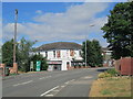
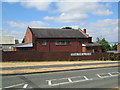
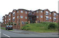
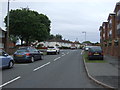
20 photos from this area
Area Information
Key information about the B65 8DW including its size, population, and administrative classification.
- Area Type
- Postcode
- Area Size
- 5.0 hectares
- Population
- 1424
- Population Density
- 3042 people/km²
House Prices in B65 8DW
83
Properties
£145,912
Average Sold Price
£57,950
Lowest Price
£280,000
Highest Price
Showing 83 properties
| Address | Type | Beds | Baths | Last Sale Price | Last Sale Date | |
|---|---|---|---|---|---|---|
| 57 Ross Heights, Rowley Regis, B65 8DW | house | - | - | £280,000 | May 2023 | |
| 53 Ross Heights, Rowley Regis, B65 8DW | Retail | 3 | 1 | £240,000 | Oct 2022 | |
| 26 Ross Heights, Rowley Regis, B65 8DW | house | - | - | £250,000 | Aug 2022 | |
| 69 Ross Heights, Rowley Regis, B65 8DW | Retail | 3 | 1 | £255,000 | May 2022 | |
| 39 Ross Heights, Rowley Regis, B65 8DW | Semi-detached | 3 | 1 | £218,500 | Oct 2019 | |
| 30 Ross Heights, Rowley Regis, B65 8DW | house | - | - | £168,000 | Dec 2018 | |
| 14 Ross Heights, Rowley Regis, B65 8DW | Semi-detached | 3 | 1 | £167,000 | Jul 2016 | |
| 17 Ross Heights, Rowley Regis, B65 8DW | Semi-detached | 3 | 1 | £145,000 | Jun 2016 | |
| 61 Ross Heights, Rowley Regis, B65 8DW | house | 3 | - | £155,000 | Jun 2015 | |
| 11 Ross Heights, Rowley Regis, B65 8DW | Semi-detached | 3 | 1 | £149,000 | May 2015 |
Page 1 of 9
Energy Efficiency in B65 8DW
Amenities
Schools
| Rank | School | Type | Entry gender | Ages |
|---|
Explore more schools in this area
Go to Schools tabDemographics
Household Size
Two person
most common
Accommodation Type
Houses
most common
Tenure
70
majority
Ethnic Group
White
most common
Religion
N/A
most common
Household Composition
N/A
most common
Age
47
median
Adults (30-64 years)
most common
Household Deprivation
N/A
with no deprivation
NS-SEC
26
in Lower managerial occupations
Explore more demographic insights in this area
Go to Demographics tabPlanning
Planning Constraints
- Flood RiskPremium
- Ramsar Wetland SitesPremium
- Area of Outstanding Natural BeautyPremium
- Protected Nature ReservePremium
- Protected WoodlandPremium