Area Overview for B65 0RN
Photos of B65 0RN
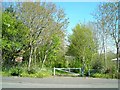
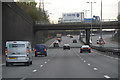

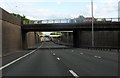
47 photos from this area
Area Information
Key information about the B65 0RN including its size, population, and administrative classification.
- Area Type
- Postcode
- Area Size
- 8407 m²
- Population
- 1457
- Population Density
- 3152 people/km²
House Prices in B65 0RN
25
Properties
£129,101
Average Sold Price
£102,000
Lowest Price
£198,000
Highest Price
Showing 25 properties
| Address | Type | Beds | Baths | Last Sale Price | Last Sale Date | |
|---|---|---|---|---|---|---|
| 32 Harrold Road, Rowley Regis, B65 0RN | Semi-detached | 4 | 1 | £198,000 | Mar 2024 | |
| 16 Harrold Road, Rowley Regis, B65 0RN | house | - | - | £147,005 | Oct 2020 | |
| 4 Harrold Road, Rowley Regis, B65 0RN | Semi-detached | 2 | 2 | £120,000 | Mar 2019 | |
| 10 Harrold Road, Rowley Regis, B65 0RN | Semi-detached | 3 | 1 | £131,500 | Mar 2018 | |
| 26 Harrold Road, Rowley Regis, B65 0RN | house | - | - | £114,950 | Nov 2010 | |
| 22 Harrold Road, Rowley Regis, B65 0RN | Semi-detached | - | - | £122,500 | Jun 2008 | |
| 24 Harrold Road, Rowley Regis, B65 0RN | Semi-detached | - | - | £115,950 | Jul 2007 | |
| 42 Harrold Road, Rowley Regis, B65 0RN | Semi-detached | - | - | £110,000 | Apr 2005 | |
| 8 Harrold Road, Rowley Regis, B65 0RN | Semi-detached | 3 | 1 | £102,000 | Jan 2005 | |
| 46 Harrold Road, Rowley Regis, B65 0RN | Semi-detached | - | - | - | - |
Page 1 of 3
Energy Efficiency in B65 0RN
Amenities
Schools
| Rank | School | Type | Entry gender | Ages |
|---|
Explore more schools in this area
Go to Schools tabDemographics
Household Size
Family (3-5 people)
most common
Accommodation Type
Houses
most common
Tenure
68
majority
Ethnic Group
White
most common
Religion
N/A
most common
Household Composition
N/A
most common
Age
47
median
Adults (30-64 years)
most common
Household Deprivation
N/A
with no deprivation
NS-SEC
21
in Lower managerial occupations
Explore more demographic insights in this area
Go to Demographics tabPlanning
Planning Constraints
- Flood RiskPremium
- Ramsar Wetland SitesPremium
- Area of Outstanding Natural BeautyPremium
- Protected Nature ReservePremium
- Protected WoodlandPremium