Area Overview for B65 0HZ
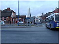
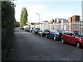
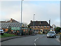
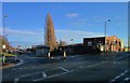
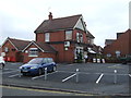
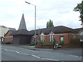
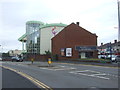
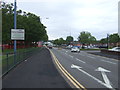
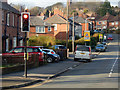
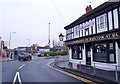
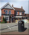
Photos of B65 0HZ
Area Information
Living in B65 0HZ means residing in a small residential cluster within the Blackheath Ward of Sandwell Metropolitan Borough. The population of this specific postcode area stands at 1,598, offering a sense of community not found in larger urban sprawls. Historically, this area traces its origins to Bleak Heath, evolving from farm houses and inns along the turnpike road from Oldbury to Halesowen. Following the Industrial Revolution, it developed as a dormitory settlement for workers in local industries such as coal mining and quarrying. Today, the landscape is defined by its status as a distinct electoral ward nestled within the broader Blackheath town. Residents benefit from a proximity to significant transport links, including railway stations in Rowley Regis, Old Hill, and Langley Green. The local character reflects this historical transition from an industrial worker hub to a quieter residential enclave. You are situated in an environment where the legacy of the 19th-century railway, which opened in 1867, continues to influence daily commutes. While the area lacks the density of major city centres, it provides essential access to retail outlets like Sainsburys and Iceland within practical reach. The narrative of this postcode is one of stable, established living in a location that has survived significant administrative reorganisations since 1966 and 1974 to become the place it is today.
- Area Type
- Postcode
- Area Size
- Not available
- Population
- 1598
- Population Density
- 5362 people/km²
The property market in B65 0HZ is characterised by a concentration of houses, with no data suggesting a significant presence of flats or purpose-built apartments within this small cluster. With only 1,598 residents, the housing stock is likely dominated by family homes built to accommodate the historical workforce of the nearby industries. The home ownership rate is recorded at 37 per cent, indicating that while a substantial portion of residents own their property, a comparable share of the market operates under tenancy agreements. This balance often reflects a market where local jobs and moving costs influence purchasing decisions alongside traditional investment logic. Buyers looking at this postcode should expect smaller, clustered developments rather than large estate subdivisions or high-rise complexes common in larger city wards. The restricted nature of the housing supply may drive competition for available stock, potentially keeping prices steady if new construction is limited by planning constraints. Living in B65 0HZ means accessing a market that favours traditional house types over modern apartment living. The area's history as a dormitory settlement for industrial workers suggests that the existing homes may include older, working-class cottages or terraced houses from the later 19th and early 20th centuries. Prospective buyers should treat this as a niche market where inventory turnover can be slower due to the limited number of properties and the specific demographic choices of long-term residents.
House Prices in B65 0HZ
No properties found in this postcode.
Energy Efficiency in B65 0HZ
The lifestyle in B65 0HZ is defined by practical accessibility to essential amenities without the need to travel far. Five retail outlets are situated within practical reach, providing convenience for daily shopping needs. Notable businesses include Sainsburys Blackheath, Iceland Blackheath, and Heron Blackheath, which serve as primary destinations for groceries and household essentials. For those needing broader rail connections or transit points, five rail and metro locations are nearby, including Rowley Regis, Old Hill, and Langley Green stations, alongside Kenrick Park and West Bromwich Central. These transport hubs act as gateways for wider exploration beyond the immediate residential cluster. The area retains a quiet character, historically shaped by its industrial past involving coal mining and manufacturing before shifting to a residential focus. While the distance to urban centres is not specified by kilometres in the data, the presence of these amenities suggests a distance understandable on foot or short car journey. Residents enjoy a lifestyle that balances suburban quiet with the immediate utility of local shops and transport nodes. There is no data on specific leisure parks or dining venues beyond the major retailers, so the lifestyle focus remains firmly on utility and transport connectivity. Living in B65 0HZ means having your supermarket and bus or train station located in the immediate vicinity, reducing the time spent commuting for basic necessities.
Amenities
Schools
For families considering living in B65 0HZ, access to quality education is a key consideration. The nearest school listed in the data is Highfields Primary School. This institution operates as a primary school and holds a 'good' Ofsted rating, indicating a standard of education deemed satisfactory by inspectors. While the area contains historical educational institutions such as Blackheath Primary School, which was originally built on Powke Lane before relocating to Britannia Road in 2005, Highfields appears to be the primary option explicitly rated in the current dataset for this specific postcode. A 'good' rating generally reflects strong teaching standards, positive behaviour management, and effective curriculum delivery. There are no secondary schools or further education colleges explicitly detailed in the immediate data for this narrow cluster, meaning older children may rely on schools located in the wider Blackheath or Rowley Regis area. Parents should verify catchment zones early, as specific ward boundaries often determine eligibility for these nearby schools. The presence of a single, well-rated primary entrance point suggests that the local family demographic is stable enough to support a focused primary education hub without the need for multiple overlapping facilities within the immediate window walk distance.
| Rank | School | Type | Entry gender | Ages |
|---|
Explore more schools in this area
Go to Schools tabDemographics
The community in B65 0HZ is defined by a settled demographic profile with a median age of 47 years. The majority of residents fall within the adult age range of 30 to 64 years, suggesting a population that has put down roots rather than relying on transient student or young professional housing. Home ownership rates stand at 37 per cent, a figure that indicates a relatively balanced mix of owner-occupiers and renters compared to similar suburban postcodes. This ownership level suggests a shared investment in local improvements alongside a rental sector that caters to those not yet ready to buy. The predominant ethnic group is White, which aligns with the historical settlement patterns of the West Midlands region. Accommodation types almost exclusively consist of houses, confirming that flats are rare in this specific cluster. The area is also historically noted for a notable incident in 1959 that marked it as a stage for social change, though current diversity figures show a chiefly White population. You are living in an area where the demographic weight falls heavily on middle-aged families and empty nesters rather than young couples or single executives. This age structure often correlates with a lower noise profile and a demand for stability over rapid development, shaping the local character significantly.
Household Size
Accommodation Type
Tenure
Ethnic Group
Religion
Household Composition
Age
Household Deprivation
NS-SEC
Explore more demographic insights in this area
Go to Demographics tabPlanning
Planning Constraints
- Flood RiskPremium
- Ramsar Wetland SitesPremium
- Area of Outstanding Natural BeautyPremium
- Protected Nature ReservePremium
- Protected WoodlandPremium