Area Overview for B65 0DY
Photos of B65 0DY
Area Information
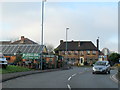
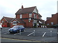
Living in B65 0DY means settling into a specific residential cluster within the Blackheath ward of Sandwell Metropolitan Borough. This area represents a small but distinct community, sitting within the broader historical footprint that traces back to *Bleak Heath* before the 19th century. The locality functions as a dormitory settlement attached to the larger Blackheath town, which itself developed significantly after the establishment of St Paul's Church in 1865 and the Great Western Railway station in 1867. With a population recorded at 1,598, this postcode covers a concentrated group of homes rather than a sprawling suburb. Residents here share a connection to a town that evolved from a coal mining and manufacturing centre, driven historically by industries like the Excelsior Works and British Thomson-Houston. Daily life revolves around this tight-knit community structure, offering a sense of locality without the isolation of rural living. Prospective buyers looking for this specific code are entering an area defined by its administrative history and proximity to the commercial and industrial past of the wider region. The environment remains practical and functional, serving as a modern extension of the original Rowley Regis glebe lands sold decades ago.
- Area Type
- Postcode
- Area Size
- Not available
- Population
- 1598
- Population Density
- 5362 people/km²
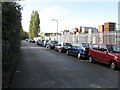
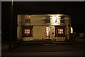
Homes in B65 0DY are exclusively houses, forming the complete accommodation type for this residential cluster. With a home ownership rate of 37%, the market is split between owner-occupiers and private tenants. This relatively low ownership rate compared to other parts of the country suggests a strong rental sector exists alongside the privately owned stock. Because this postcode covers a small residential cluster, inventory will be limited compared to larger towns. Buyers seeking properties here will find a stock defined by houses rather than flats or bungalows. The specific nature of the area as a small cluster means new developments are unlikely, preserving the existing character of the housing stock. Residents buying property can expect to join a community where nearly two-thirds of households are renting. This dynamic often results in competitive rental markets while keeping purchase prices potentially lower than in areas with high owner-occupancy rates. The focus remains on traditional house types serving the adult population identified in local records.
House Prices in B65 0DY
No properties found in this postcode.
Energy Efficiency in B65 0DY
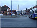
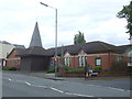
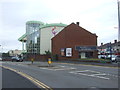
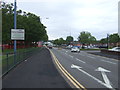
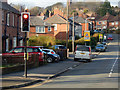
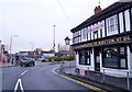
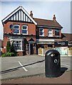
Life in B65 0DY benefits from a variety of amenities within practical reach of the residential cluster. Residents can access five retail venues, including Heron Blackheath, Iceland Blackheath, and Sainsburys Blackheath for shopping needs. Transport options are robust, with five railway stations like Langley Green and Kenrick Park nearby, alongside five metro stations offering city centre links. These amenities provide essential convenience for daily errands and leisure activities. The option to shop at supermarkets like Sainsburys means fresh groceries are available without a long journey. Commuters have access to a network of five rail and metro stations, facilitating travel beyond the immediate Sandwell borough. The concentration of retail and transport infrastructure creates a self-sufficient lifestyle for those living here. You do not need to venture far for basic necessities or regional travel connections. The area functions effectively as a suburb supported by established commercial and transport nodes.
Amenities
Schools
Families in B65 0DY have access to education establishments, primarily focused on early years through primary education. The nearest and only school with specific data in the immediate vicinity is Highfields Primary School. This institution holds an Ofsted rating of good, providing a verified standard of education for local children. While there is no secondary school listed in the immediate cluster data, the presence of a good-rated primary school ensures early education needs are met within the neighbourhood. For prospective homebuyers, the existence of a school with a good rating is a concrete positive factor for choosing this location. The school environment is established and rated positively by regulators, which often correlates with stable community engagement. Parents relying on schools near B65 0DY can depend on the specific performance metrics attached to Highfields Primary School. No other educational institutions are listed in the provided local school data, meaning families must look beyond this immediate cluster for secondary or further education options.
| Rank | School | Type | Entry gender | Ages |
|---|
Explore more schools in this area
Go to Schools tabDemographics
The community profile of B65 0DY is dominated by people in the 30 to 64 age bracket, with a median age of 47 years. This indicates a population consisting largely of adults rather than young families or very elderly residents. Home ownership stands at 37%, meaning the majority of the 1,598 residents live in rental accommodation. The predominant ethnicity for the area is White. Houses form the primary type of accommodation available within this cluster. This demographic mix suggests a mature neighbourhood where long-term residents are balanced by a significant tenant population. The concentration of adults in middle age aligns with the historical context of an area that served as a dormitory for workers in surrounding industries. While the ethnic makeup is currently one of the main data points visible, the age structure implies a steady purchasing power base in the form of working-age adults. There are no youth groups or significant elderly care populations highlighted in the current figures, pointing toward a working-class or semi-independent household demographic.
Household Size
Accommodation Type
Tenure
Ethnic Group
Religion
Household Composition
Age
Household Deprivation
NS-SEC
Explore more demographic insights in this area
Go to Demographics tabPlanning
Planning Constraints
- Flood RiskPremium
- Ramsar Wetland SitesPremium
- Area of Outstanding Natural BeautyPremium
- Protected Nature ReservePremium
- Protected WoodlandPremium