Area Overview for B65 0DF
Photos of B65 0DF
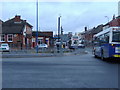
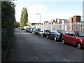
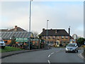
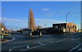
32 photos from this area
Area Information
Key information about the B65 0DF including its size, population, and administrative classification.
- Area Type
- Postcode
- Area Size
- 2826 m²
- Population
- 1598
- Population Density
- 5362 people/km²
House Prices in B65 0DF
14
Properties
£129,625
Average Sold Price
£72,000
Lowest Price
£182,000
Highest Price
Showing 14 properties
| Address | Type | Beds | Baths | Last Sale Price | Last Sale Date | |
|---|---|---|---|---|---|---|
| 9 The Heathlands, Rowley Regis, B65 0DF | Semi-detached | 1 | 1 | £182,000 | Sep 2024 | |
| 10 The Heathlands, Rowley Regis, B65 0DF | Semi-detached | 1 | 1 | £171,000 | Dec 2023 | |
| 4 The Heathlands, Rowley Regis, B65 0DF | Terraced | 2 | 1 | £162,000 | Nov 2022 | |
| 6 The Heathlands, Rowley Regis, B65 0DF | Terraced | 2 | 1 | £115,000 | Feb 2019 | |
| 15 The Heathlands, Rowley Regis, B65 0DF | Terraced | 2 | 1 | £123,000 | Oct 2018 | |
| 5 The Heathlands, Rowley Regis, B65 0DF | Terraced | 2 | 1 | £90,000 | Aug 2013 | |
| 1 The Heathlands, Rowley Regis, B65 0DF | Terraced | - | - | £122,000 | Oct 2004 | |
| 11 The Heathlands, Rowley Regis, B65 0DF | Terraced | - | - | £72,000 | Feb 2003 | |
| 2 The Heathlands, Rowley Regis, B65 0DF | Terraced | 2 | 1 | - | - | |
| 3 The Heathlands, Rowley Regis, B65 0DF | Terraced | - | - | - | - |
Page 1 of 2
Energy Efficiency in B65 0DF
Amenities
Schools
| Rank | School | Type | Entry gender | Ages |
|---|
Explore more schools in this area
Go to Schools tabDemographics
Household Size
One person
most common
Accommodation Type
Houses
most common
Tenure
37
majority
Ethnic Group
White
most common
Religion
N/A
most common
Household Composition
N/A
most common
Age
47
median
Adults (30-64 years)
most common
Household Deprivation
N/A
with no deprivation
NS-SEC
18
in Lower managerial occupations
Explore more demographic insights in this area
Go to Demographics tabPlanning
Planning Constraints
- Flood RiskPremium
- Ramsar Wetland SitesPremium
- Area of Outstanding Natural BeautyPremium
- Protected Nature ReservePremium
- Protected WoodlandPremium