Area Overview for B64 7BZ
Photos of B64 7BZ
Area Information
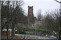
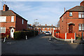
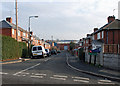
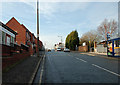
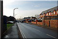
Living in B64 7BZ means being part of a small, residential cluster in the West Midlands, nestled within the Sandwell borough. With a population of 1,851, this area reflects the character of Cradley Heath and Old Hill, historically shaped by industrial heritage and now transitioning into a more settled community. Situated around 8 miles west of Birmingham, it balances proximity to urban amenities with a quieter, semi-rural feel. The area’s history as a heathland and former chain-making hub is still evident in its architecture and local landmarks, such as Haden Hill Park and listed buildings like the Church of the Holy Trinity. Daily life here is defined by a mix of practicality and tradition, with residents benefiting from nearby retail, transport links, and a strong sense of local identity. The area’s small size means it is tightly knit, with amenities and services within walking or short driving distance. For those seeking a place with roots in industry but a modern, manageable scale, B64 7BZ offers a distinct blend of history and convenience.
- Area Type
- Postcode
- Area Size
- Not available
- Population
- 1851
- Population Density
- 2465 people/km²
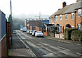
The property market in B64 7BZ is dominated by owner-occupied homes, with 63% of residents owning their properties. This contrasts with areas where rental markets are more prominent, indicating a community of long-term residents rather than transient tenants. The accommodation type is primarily houses, which is unusual for many urban postcode areas and suggests a more spread-out, suburban layout. This housing stock may appeal to buyers seeking larger living spaces or those prioritising privacy over high-density living. Given the area’s small size, the property market is likely limited in scale, with limited scope for development due to planning constraints. Buyers should consider the local character and historical context when evaluating properties, as the area’s industrial past may influence architectural styles and land use. The high home ownership rate also implies a relatively stable market with fewer fluctuations compared to more rental-dependent areas.
House Prices in B64 7BZ
No properties found in this postcode.
Energy Efficiency in B64 7BZ
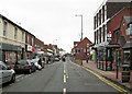
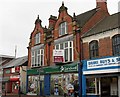
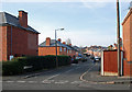
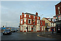
The lifestyle in B64 7BZ is shaped by its proximity to a range of practical amenities. Retail options include Iceland Cradley, Lidl Cradley, and Tesco Cradley, offering everyday shopping needs within easy reach. The area’s rail and metro stations—Cradley Heath, Old Hill, Lye, Dartmouth Street, Lodge Road, and Trinity Way—provide convenient access to public transport, linking residents to nearby towns and Birmingham. Nearby parks such as Haden Hill Park and Mary MacArthur Memorial Gardens offer green spaces for leisure and recreation. The presence of listed buildings and historical sites, like Haden Hall and the Church of the Holy Trinity, adds cultural depth to daily life. While the area is small, its amenities are designed for practicality, ensuring residents can access essentials without long commutes. This balance of retail, transport, and green space supports a lifestyle that prioritises convenience and community.
Amenities
Schools
Residents of B64 7BZ have access to two named schools: Timbertree Primary School, a primary institution, and Timbertree Academy, an academy. These schools serve the local community, providing education from early years through to secondary level. The presence of both a primary school and an academy suggests a comprehensive educational offering for families, though no Ofsted ratings or performance data are provided in the data. The proximity of these schools to the area makes them a key consideration for homebuyers prioritising education. The lack of additional schools in the data means the current options are limited to these two, which may influence decisions about school catchment areas and long-term family planning. Families should assess the specific needs of their children against the available curriculum and facilities at these institutions.
| Rank | School | Type | Entry gender | Ages |
|---|
Explore more schools in this area
Go to Schools tabDemographics
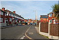
The population of B64 7BZ has a median age of 47, with the majority of residents falling within the 30-64 age range. This suggests a community skewed towards adults, likely including families and professionals. Home ownership is high at 63%, indicating a stable, long-term resident base. The predominant accommodation type is houses, which aligns with the area’s residential character. The predominant ethnic group is White, reflecting broader demographic trends in the region. While no specific deprivation data is provided, the high home ownership rate and presence of schools and amenities suggest a generally stable quality of life. The absence of significant diversity data means the community’s social composition remains largely homogeneous, though this does not necessarily imply a lack of inclusivity. The age profile suggests a mature population, which may influence local services and infrastructure needs.
Household Size
Accommodation Type
Tenure
Ethnic Group
Religion
Household Composition
Age
Household Deprivation
NS-SEC
Explore more demographic insights in this area
Go to Demographics tabPlanning
Planning Constraints
- Flood RiskPremium
- Ramsar Wetland SitesPremium
- Area of Outstanding Natural BeautyPremium
- Protected Nature ReservePremium
- Protected WoodlandPremium