Area Overview for B64 6BT
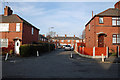
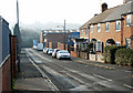
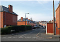
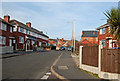
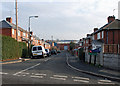
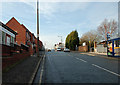
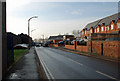
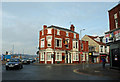
Photos of B64 6BT
Area Information
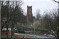
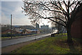
B64 6BT lies in the heart of Sandwell, West Midlands, a small residential cluster within the Black Country, approximately 8 miles west of Birmingham city centre. The area, known as Cradley Heath and Old Hill Ward, has a population of 2329, reflecting a compact, tightly knit community. Historically shaped by the chain-making industry, it retains echoes of its industrial past, with listed buildings like Corngreaves Hall and Haden Hill Park offering green spaces amid the urban fabric. Today, the area balances its heritage with modern connectivity, including rail links to Birmingham and nearby enterprise zones. The median age of 47 suggests a mature population, with a strong presence of adults aged 30–64. This demographic, combined with the area’s proximity to Birmingham, makes it appealing for those seeking a quieter lifestyle without sacrificing access to major city amenities.
- Area Type
- Postcode
- Area Size
- Not available
- Population
- 2329
- Population Density
- 5815 people/km²
B64 6BT’s property market is characterised by a 47% home ownership rate, suggesting a blend of owner-occupied and rental properties. The accommodation type is predominantly houses, indicating a low-density, suburban layout with limited high-rise or apartment developments. This mix may appeal to buyers seeking traditional homes in a quieter setting, though the small area size means the housing stock is not extensive. The proximity to Birmingham and nearby enterprise zones could offer opportunities for investment, particularly in areas transitioning from industrial to residential use. However, buyers should consider the limited local supply and the need to explore nearby areas for a broader range of options.
House Prices in B64 6BT
No properties found in this postcode.
Energy Efficiency in B64 6BT
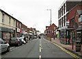
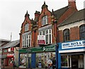
Daily life in B64 6BT is shaped by its proximity to retail, transport, and green spaces. Nearby amenities include Tesco Cradley, Iceland Cradley, and Lidl Cradley, offering convenience for shopping. Rail and metro stations provide easy access to Birmingham and surrounding areas, while Haden Hill Park offers a recreational space with historical significance. The area’s character is defined by its mix of traditional housing, listed buildings, and modern enterprise zones. This blend of heritage and practicality supports a lifestyle that balances community roots with contemporary needs. The availability of multiple schools, shops, and transport links ensures residents can access essentials without long commutes, though the small area size means amenities are concentrated within a short radius.
Amenities
Schools
Residents of B64 6BT have access to a range of educational institutions. Corngreaves Primary School and Reddal Hill Primary School both offer primary education, with the latter holding a ‘good’ Ofsted rating. Corngreaves Academy, an academy school, and Impact Independent School, a private institution, also provide options for secondary education, both rated ‘good’ by Ofsted. This mix of state and independent schools allows families to choose between public and private education. The presence of multiple schools with strong ratings suggests a commitment to educational quality, though parents should verify specific catchment areas and admissions policies for each institution.
| Rank | School | Type | Entry gender | Ages |
|---|
Explore more schools in this area
Go to Schools tabDemographics
The population of B64 6BT is predominantly adults aged 30–64, with a median age of 47. Home ownership stands at 47%, indicating a mix of owner-occupied and rental properties. The accommodation type is primarily houses, reflecting a low-density, suburban character. The predominant ethnic group is White, with no specific data provided on other demographics. While the area’s age profile suggests stability, the home ownership rate is slightly below average, hinting at a rental market presence. This balance may influence the local economy, with services tailored to a mature, established community. The absence of detailed diversity data means the area’s cultural makeup remains less defined in public records.
Household Size
Accommodation Type
Tenure
Ethnic Group
Religion
Household Composition
Age
Household Deprivation
NS-SEC
Explore more demographic insights in this area
Go to Demographics tabPlanning
Planning Constraints
- Flood RiskPremium
- Ramsar Wetland SitesPremium
- Area of Outstanding Natural BeautyPremium
- Protected Nature ReservePremium
- Protected WoodlandPremium