Area Overview for B64 6BH
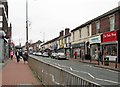
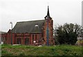
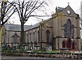
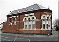
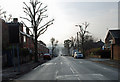
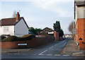
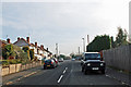
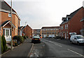
Photos of B64 6BH
Area Information
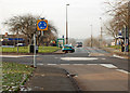
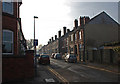
Living in B64 6BH offers a settled lifestyle within a defined residential cluster in the Black Country. This postcode covers 774 m² of urban space and serves a population of 2,329 people. The location sits approximately 8 miles west of Birmingham city centre near coordinates 52.463394, -2.064703. It forms part of the Cradley Heath and Old Hill Ward in the metropolitan borough of Sandwell, West Midlands. Daily life here is structured around the historic urban areas of Cradley Heath and Old Hill. You find a community rooted in the region's industrial past, transitioning into a modern residential zone. The area retains its distinct identity away from the city core while remaining accessible via major transport links. Residents benefit from proximity to established commercial hubs like Rowley Regis and West Bromwich. This small, contained environment fosters a sense of local community known to those working or living in the Black Country. The setting provides a quiet alternative to high-density city living without sacrificing connectivity to wider markets.
- Area Type
- Postcode
- Area Size
- 774 m²
- Population
- 2329
- Population Density
- 5815 people/km²
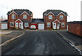
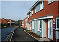
The property market in B64 6BH is characterised by traditional housing and significant owner occupancy. Specifically, 47% of the housing stock is owner-occupied, marking this as a district where residents frequently purchase rather than rent. The accommodation type is predominantly houses, which appeals to families and professionals seeking standalone properties rather than flats. This residential cluster of 774 m² supports a market focused on established homes rather than high-density blocks. Buyers looking at B64 6BH should expect a stock of family-sized properties typical of the Black Country heritage. The balance of ownership suggests a stable market with fewer short-term tenancies compared to metropolitan city centres. This structure benefits those tired of the rental ladder who wish to settle in a specific postcode. The presence of houses as the primary accommodation type ensures a neighbourhood feel that prioritises yard space and garden access. For anyone considering homes in B64 6BH, the market presents a clear focus on permanent residence over transient living arrangements.
House Prices in B64 6BH
Showing 2 properties
| Address | Type | Beds | Baths | Last Sale Price | Last Sale Date | |
|---|---|---|---|---|---|---|
| Flat 2, 45 Queen Street, Cradley Heath, B64 6BH | Flat | - | - | - | - | |
| Flat 1, 45 Queen Street, Cradley Heath, B64 6BH | Flat | - | - | - | - |
Energy Efficiency in B64 6BH
Lifestyle in B64 6BH revolves around convenient access to retail and leisure amenities within practical reach. Residents have immediate access to five key retail locations, including Tesco Cradley, Iceland Cradley, and Lidl Cradley. These supermarkets form the backbone of daily shopping routines for the 2,329 people living in the area. For commuters, three major railway stations offer fast rail links, such as Cradley Heath Railway Station, Old Hill Railway Station, and Lye Railway Station. These stations connect local residents to the broader West Midlands transport network efficiently. Leisure pursuits are supported by the presence of Haden Hill Park, which features Haden Hall and Haden Old Hall. This historic site offers a green space for walks and family outings near coordinates 52.463394, -2.064703. The area also includes Mary MacArthur Memorial Gardens in Lomey Town park, commemorating significant local labour history. This blend of modern convenience and historical sites provides a rich lifestyle. You can shop for essentials, commute to Birmingham, or enjoy a walk among Tudor ruins without leaving the region.
Amenities
Schools
Families residing in B64 6BH have access to a diverse range of educational institutions, including state and independent options. Corngreaves Primary School serves the local primary sector, providing early education alongside education delivered by Reddal Hill Primary School. Reddal Hill holds a good Ofsted rating, offering a quality standard for young pupils. Beyond the primary years, Corngreaves Academy operates as an academy with a good Ofsted rating, ensuring continuity for teenagers in the area. For families seeking alternatives to state education, Impact Independent School is available and also carries a good Ofsted rating. This mix means parents can choose between excellent state-funded options or private education within the immediate vicinity. The presence of multiple schools with good ratings suggests a strong educational infrastructure for the 2,329 residents. You do not need to commute far for schooling, as these facilities cover the needs of children from nursery age through to secondary level within the B64 6BH catchment and surrounding areas.
| Rank | School | Type | Entry gender | Ages |
|---|
Explore more schools in this area
Go to Schools tabDemographics
The community in B64 6BH reflects a mature and established population. The median age stands at 47 years, indicating a resident base that is largely composed of adults between 30 and 64 years old. This age profile suggests stability and long-term tenancy rather than a transient student or young professional demographic. Home ownership is prevalent here, with 47% of residents owning their homes outright or with a mortgage. The remaining 53% likely comprise renters, reflecting a balanced mix of investment and private ownership. The accommodation type is primarily houses, distinguishing this postcode from areas dominated by flats or apartments. The predominant ethnic group is White, aligning with the broader demographic trends of the West Midlands region. Visitors to the area will notice a neighbourhood settled for generations, where family structures and generational roots define the social fabric. This demographic profile creates a consistent environment for those seeking a predictable community atmosphere.
Household Size
Accommodation Type
Tenure
Ethnic Group
Religion
Household Composition
Age
Household Deprivation
NS-SEC
Explore more demographic insights in this area
Go to Demographics tabPlanning
Planning Constraints
- Flood RiskPremium
- Ramsar Wetland SitesPremium
- Area of Outstanding Natural BeautyPremium
- Protected Nature ReservePremium
- Protected WoodlandPremium