Area Overview for B64 6BG
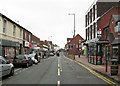
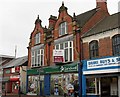
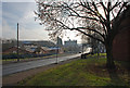
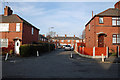
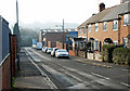
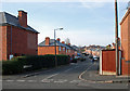
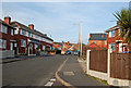
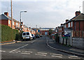
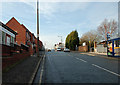
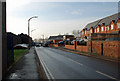
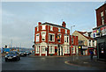
Photos of B64 6BG

Area Information
B64 6BG lies in the Cradley Heath and Old Hill Ward of Sandwell, West Midlands, approximately 8 miles west of Birmingham city centre. This small postcode area encompasses a compact residential cluster with a population of 2094, reflecting its modest scale. Historically a heathland settlement, the area evolved from 17th-century squatter communities and became known for its chain-making industry in the 19th century. Today, it retains echoes of its industrial past, with listed buildings like the Church of the Holy Trinity and Haden Hill Park offering green spaces amid urban living. The area is served by multiple rail and metro stations, connecting residents to nearby towns and Birmingham. While its population is small, the community benefits from proximity to retail hubs like Iceland Cradley and Tesco Cradley, as well as cultural landmarks such as the Mary MacArthur Memorial Gardens. Living here offers a blend of historical character and modern convenience, though the area’s compact size means amenities are tightly concentrated.
- Area Type
- Postcode
- Area Size
- Not available
- Population
- 2094
- Population Density
- 2573 people/km²
The property market in B64 6BG is characterised by a 46% home ownership rate, with houses forming the predominant accommodation type. This suggests a mix of owner-occupied and rental properties, though the small size of the area limits the diversity of housing stock. The focus on houses rather than flats or apartments indicates a preference for family homes, potentially appealing to buyers seeking space and privacy. However, the compact nature of the postcode means property choices are limited, and buyers may need to look beyond immediate surroundings for more options. The market is likely influenced by the area’s historical roots and proximity to transport links, though its small size may restrict growth potential. For those prioritising home ownership in a residential setting, B64 6BG offers a niche opportunity, but buyers should consider the limited scope for expansion.
House Prices in B64 6BG
No properties found in this postcode.
Energy Efficiency in B64 6BG
Daily life in B64 6BG is shaped by its proximity to retail, transport, and green spaces. The area’s retail offerings include Iceland Cradley, Tesco Cradley, and Lidl Cradley, providing essential shopping options within walking distance. For leisure, Haden Hill Park offers a peaceful escape with Haden Hall and Haden Old Hall, while the Mary MacArthur Memorial Gardens add historical interest. The nearby enterprise zone in the eastern part of the area hints at potential for development, though no major employers are listed. Transport links to rail and metro stations ensure easy access to Birmingham and beyond, supporting both work and social activities. The blend of local amenities and connectivity creates a functional, though compact, lifestyle, ideal for those prioritising convenience over sprawling suburban living.
Amenities
Schools
The only school explicitly listed near B64 6BG is Cradley Heath Nursery School, which serves young children. No primary or secondary schools are mentioned in the data, meaning families with older children may need to look further afield for education. The presence of a nursery suggests some local provision for early years education, though the absence of higher-level schools implies a reliance on nearby towns for comprehensive schooling. This could be a consideration for prospective buyers with children, as the area’s small size may not accommodate a full range of educational facilities. Parents may need to factor in commuting times to schools in Cradley, Old Hill, or Birmingham.
| Rank | School | Type | Entry gender | Ages |
|---|
Explore more schools in this area
Go to Schools tabDemographics
The population of B64 6BG has a median age of 47, with the majority of residents falling within the 30-64 age range. This suggests a mature, established community with a focus on family living. Home ownership rates stand at 46%, indicating a mix of owner-occupied and rental properties. The predominant accommodation type is houses, reflecting a residential character distinct from high-density housing. The predominant ethnic group is White, though no further breakdown of diversity is provided. The age profile and home ownership figures suggest a stable, long-term resident base, with fewer young families or transient populations. The absence of specific data on deprivation means the area’s socioeconomic challenges remain unquantified, but the demographic stability implies a relatively cohesive community.
Household Size
Accommodation Type
Tenure
Ethnic Group
Religion
Household Composition
Age
Household Deprivation
NS-SEC
Explore more demographic insights in this area
Go to Demographics tabPlanning
Planning Constraints
- Flood RiskPremium
- Ramsar Wetland SitesPremium
- Area of Outstanding Natural BeautyPremium
- Protected Nature ReservePremium
- Protected WoodlandPremium