Area Overview for B64 5ER
Photos of B64 5ER
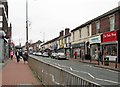
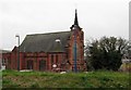
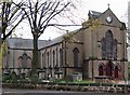
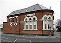
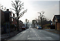
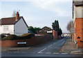
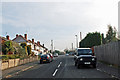
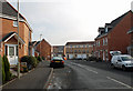
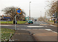
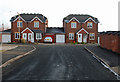
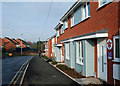
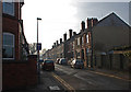
83 photos from this area
Area Information
Key information about the B64 5ER including its size, population, and administrative classification.
- Area Type
- Postcode
- Area Size
- 1.3 hectares
- Population
- 2329
- Population Density
- 5815 people/km²
House Prices in B64 5ER
18
Properties
£111,625
Average Sold Price
£70,000
Lowest Price
£150,000
Highest Price
Showing 18 properties
| Address | Type | Beds | Baths | Last Sale Price | Last Sale Date | |
|---|---|---|---|---|---|---|
| 19 Allbut Street, Cradley Heath, B64 5ER | Terraced | 3 | 1 | £150,000 | Feb 2021 | |
| 27 Allbut Street, Cradley Heath, B64 5ER | house | - | - | £145,000 | Aug 2018 | |
| 26 Allbut Street, Cradley Heath, B64 5ER | Semi-detached | 3 | - | £118,000 | Dec 2014 | |
| 29 Allbut Street, Cradley Heath, B64 5ER | house | 3 | - | £120,000 | Aug 2013 | |
| 28 Allbut Street, Cradley Heath, B64 5ER | house | 3 | - | £116,000 | Jul 2013 | |
| 24 Allbut Street, Cradley Heath, B64 5ER | house | - | - | £100,000 | Jun 2012 | |
| 14 Allbut Street, Cradley Heath, B64 5ER | house | - | - | £70,000 | Mar 2003 | |
| 22 Allbut Street, Cradley Heath, B64 5ER | Terraced | - | - | £74,000 | Feb 2003 | |
| 21 Allbut Street, Cradley Heath, B64 5ER | Terraced | 3 | 1 | - | - | |
| Ringside, 45 Allbut Street, Cradley Heath, B64 5ER | Detached | - | - | - | - |
Page 1 of 2
Energy Efficiency in B64 5ER
Amenities
Schools
| Rank | School | Type | Entry gender | Ages |
|---|
Explore more schools in this area
Go to Schools tabDemographics
Household Size
One person
most common
Accommodation Type
Houses
most common
Tenure
47
majority
Ethnic Group
White
most common
Religion
N/A
most common
Household Composition
N/A
most common
Age
47
median
Adults (30-64 years)
most common
Household Deprivation
N/A
with no deprivation
NS-SEC
17
in Lower managerial occupations
Explore more demographic insights in this area
Go to Demographics tabPlanning
Planning Constraints
- Flood RiskPremium
- Ramsar Wetland SitesPremium
- Area of Outstanding Natural BeautyPremium
- Protected Nature ReservePremium
- Protected WoodlandPremium