Area Overview for B64 5BU
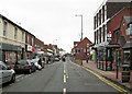
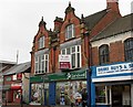
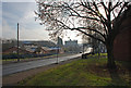
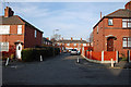
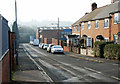
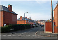
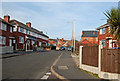
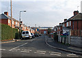
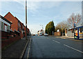
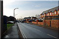
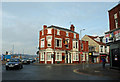
Photos of B64 5BU

Area Information
Living in B64 5BU means inhabiting a compact residential cluster in the heart of Cradley Heath and Old Hill, part of Sandwell’s metropolitan borough. With a population of 2,094, this area is small but historically rich, shaped by its 19th-century chain-making industry and the 1910 strike led by Mary MacArthur. Its proximity to Birmingham—just 8 miles east—offers easy access to the city’s amenities while retaining a distinct local character. The area’s modest size means a tight-knit community feel, with residents often familiar with one another. Nearby, Haden Hill Park and listed buildings like Corngreaves Hall provide pockets of heritage, while the enterprise zone near Rowley Regis hints at modern economic development. Daily life here balances practicality with history, with residents relying on nearby rail links and local shops. Though small, B64 5BU offers a blend of residential calm and connectivity to larger urban hubs, making it appealing to those seeking a quieter base with city accessibility.
- Area Type
- Postcode
- Area Size
- Not available
- Population
- 2094
- Population Density
- 2573 people/km²
B64 5BU’s property market is defined by a 46% home ownership rate, with houses as the primary accommodation type. This suggests a predominance of owner-occupied homes, though the relatively low ownership figure indicates a significant rental market. The area’s small size and focus on houses imply a more spread-out housing stock compared to high-density developments. Buyers should consider the limited scale of the area, meaning property choices may be constrained to individual homes rather than apartments or larger estates. The presence of nearby enterprise zones and historical industrial sites could influence future development, but current listings are likely to reflect the existing character of the neighbourhood. For those seeking a home, the emphasis on houses may appeal to families or those prioritising space, though the compact nature of B64 5BU means proximity to amenities and transport is key.
House Prices in B64 5BU
No properties found in this postcode.
Energy Efficiency in B64 5BU
Residents of B64 5BU have access to a range of local amenities within practical reach. Retail options include Lidl Cradley, Iceland Cradley, and Tesco Cradley, offering everyday shopping needs. The area’s proximity to rail stations and metro stops enhances connectivity, enabling easy travel to nearby towns and cities. For leisure, Haden Hill Park provides green space with historical features like Haden Hall, while listed buildings such as Corngreaves Hall add cultural value. The enterprise zone near Rowley Regis hints at potential for future development, though current amenities focus on practicality over luxury. The mix of retail, transport, and green spaces supports a balanced lifestyle, blending convenience with access to nature and historical sites. This makes B64 5BU appealing to those seeking a self-contained yet connected community.
Amenities
Schools
The nearest school to B64 5BU is Cradley Heath Nursery School, which serves early years education. No primary or secondary schools are listed in the data, meaning families may need to look beyond the immediate area for comprehensive schooling. The absence of higher-tier educational institutions could impact long-term plans for families, requiring consideration of commuting distances or private schooling options. The nursery’s presence suggests some local provision for young children, but the lack of broader school infrastructure highlights a potential gap in the area’s offerings. Prospective buyers should investigate nearby districts for school availability, as B64 5BU’s small size may not accommodate a full range of educational facilities.
| Rank | School | Type | Entry gender | Ages |
|---|
Explore more schools in this area
Go to Schools tabDemographics
The population of B64 5BU is 2,094, with a median age of 47, indicating a mature demographic skewed toward adults aged 30–64. Home ownership sits at 46%, suggesting a mix of owner-occupied properties and rental units. The predominant accommodation type is houses, reflecting a suburban or semi-rural layout. The majority of residents identify as White, with no specific data on other ethnic groups provided. This age profile implies a community with established careers and family structures, though the lack of younger residents may affect local schools and amenities. The home ownership rate, while moderate, suggests a stable housing market but also highlights reliance on rental options for some. The absence of detailed diversity data means broader social dynamics remain unexplored, though the area’s historical roots in industrial settlements may influence its cultural makeup.
Household Size
Accommodation Type
Tenure
Ethnic Group
Religion
Household Composition
Age
Household Deprivation
NS-SEC
Explore more demographic insights in this area
Go to Demographics tabPlanning
Planning Constraints
- Flood RiskPremium
- Ramsar Wetland SitesPremium
- Area of Outstanding Natural BeautyPremium
- Protected Nature ReservePremium
- Protected WoodlandPremium