Area Overview for B64 5AN
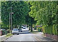
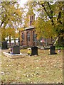
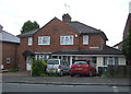
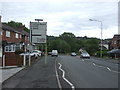
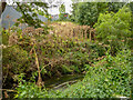
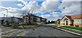
Photos of B64 5AN


Area Information
B64 5AN is a small residential postcode in Sandwell, West Midlands, encompassing parts of Cradley Heath and Old Hill in the Black Country. With a population of 2094, it reflects a compact, tight-knit community approximately 8 miles west of Birmingham. Historically shaped by heathland and the chain-making industry, the area now balances its industrial heritage with modern living. Residents benefit from proximity to multiple railway stations, including Cradley Heath and Old Hill, which link to Birmingham and beyond. The area’s character is defined by its mix of older housing stock and recent developments, with a focus on practicality over grandeur. Nearby amenities like Lidl, Iceland, and Tesco cater to daily needs, while Haden Hill Park offers green space. The community is predominantly middle-aged, with a strong presence of adults aged 30–64, suggesting a stable, long-term resident base. For those seeking a quiet yet connected life, B64 5AN offers a blend of historical roots and contemporary convenience.
- Area Type
- Postcode
- Area Size
- Not available
- Population
- 2094
- Population Density
- 2573 people/km²
B64 5AN is characterised by a housing stock that is predominantly houses, with 46% of properties owner-occupied. This suggests a balance between private ownership and rental availability, though the exact rental market dynamics are not specified. Given the small size of the postcode, the property market is likely limited in scale, with limited scope for large-scale development. The presence of older housing stock, coupled with the area’s proximity to transport links, may appeal to buyers seeking practical, family-friendly homes. However, the relatively low home ownership rate (46%) implies that a significant portion of the housing stock is rented, potentially influencing property prices and availability. Buyers should consider the area’s compact nature and its integration with surrounding towns for broader property options. The lack of high-rise or modern developments suggests a focus on traditional, low-density living.
House Prices in B64 5AN
No properties found in this postcode.
Energy Efficiency in B64 5AN
Living in B64 5AN offers access to a range of practical amenities within walking or short driving distance. Retail options include major supermarkets like Lidl, Iceland, and Tesco Cradley, ensuring daily essentials are readily available. The area’s transport links, including rail and metro stations, provide easy access to larger towns and cities. Green spaces such as Haden Hill Park offer recreational opportunities, though no specific leisure facilities like gyms or cafes are listed in the data. The presence of listed buildings like Haden Hall and the Mary MacArthur Memorial Gardens adds historical interest, though the area’s character is more pragmatic than tourist-focused. For residents, the lifestyle is defined by convenience and connectivity, with a focus on functional living rather than luxury. The compact nature of the postcode means amenities are concentrated, which can be both a benefit and a limitation depending on individual needs.
Amenities
Schools
The only named school within proximity to B64 5AN is Cradley Heath Nursery School, which provides early years education. No primary or secondary schools are listed in the data, meaning families may need to look beyond the immediate area for comprehensive schooling. The absence of higher-tier educational institutions could be a consideration for parents prioritising local schools. However, the nursery’s presence offers convenience for young children, though its Ofsted rating is not provided. For families requiring a broader range of educational options, nearby towns like Birmingham or Dudley may offer more extensive school networks. The mix of school types—limited to nurseries—suggests that B64 5AN is not a primary destination for families seeking a full spectrum of local education, though its proximity to transport links may mitigate this limitation.
| Rank | School | Type | Entry gender | Ages |
|---|
Explore more schools in this area
Go to Schools tabDemographics
The population of B64 5AN has a median age of 47, with the most common age range being adults aged 30–64. This suggests a mature, established community with limited youth or elderly populations. Home ownership stands at 46%, indicating a mix of owner-occupied and rental properties, though the exact rental proportion is unspecified. The area is predominantly composed of houses, not flats, reflecting a traditional housing stock. The predominant ethnic group is White, with no specific data on other demographics. The age profile implies a stable, low-turnover population, which may influence local services and amenities. However, the absence of detailed diversity data means the community’s full composition remains unclear. The relatively high median age could suggest a focus on family homes and long-term residency, though it may also mean fewer services tailored to younger families or retirees.
Household Size
Accommodation Type
Tenure
Ethnic Group
Religion
Household Composition
Age
Household Deprivation
NS-SEC
Explore more demographic insights in this area
Go to Demographics tabPlanning
Planning Constraints
- Flood RiskPremium
- Ramsar Wetland SitesPremium
- Area of Outstanding Natural BeautyPremium
- Protected Nature ReservePremium
- Protected WoodlandPremium