Area Overview for B63 4UJ
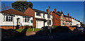
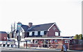
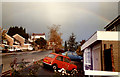
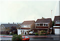
Photos of B63 4UJ
Area Information
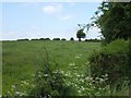
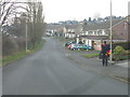
B63 4UJ is a small residential postcode area in England, part of the Halesowen region in the West Midlands. With a population of 1,457, it reflects a tight-knit community nestled within the broader Black Country urban landscape. Historically, Halesowen was an exclave of Shropshire, later transferred to Worcestershire, and now integrates seamlessly into modern suburban living. The area is defined by its proximity to Halesowen Abbey ruins, a 13th-century site under English Heritage protection, and the Leasowes, a 57-hectare public park with 18th-century landscape design. Daily life here balances historical heritage with contemporary amenities. Residents benefit from nearby retail outlets, rail connections, and a low-crime environment. The area’s compact size and strategic location make it appealing for those seeking a blend of quiet living and easy access to regional hubs. Its demographic profile, dominated by homeowners aged 30–64, suggests a stable, family-oriented community. For buyers, B63 4UJ offers a snapshot of traditional English suburbia with a focus on safety, connectivity, and proximity to green spaces.
- Area Type
- Postcode
- Area Size
- Not available
- Population
- 1457
- Population Density
- 3691 people/km²
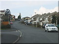
B63 4UJ is predominantly an owner-occupied area, with 85% of homes owned by residents rather than rented. The accommodation type is primarily houses, which is unusual for modern UK housing markets that often feature flats or apartments. This suggests a community of established homeowners, many of whom may have lived in their properties for years. The small size of the postcode area means the housing stock is limited, with little scope for new developments. Buyers should consider that the market is likely to be competitive, with limited inventory and high demand from those seeking stable, family-friendly homes. The predominance of houses implies larger properties, which may appeal to buyers prioritising space over affordability. However, the lack of rental properties indicates that the area is not a hotspot for investors seeking yield. For those considering purchase, the focus should be on securing a property in a well-maintained condition, given the age of many homes.
House Prices in B63 4UJ
No properties found in this postcode.
Energy Efficiency in B63 4UJ
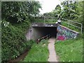
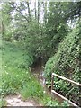
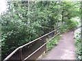
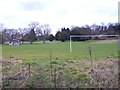
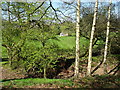
Living in B63 4UJ offers a blend of practical amenities and historical interest. Nearby retail options include Co-op Halesowen, Lidl Halesowen, and Tesco Hasbury, providing everyday shopping needs within walking or short driving distance. The area’s rail and metro connections facilitate access to larger urban centres, while the Leasowes public park offers recreational space with 18th-century landscape features. For cultural enrichment, the ruins of Halesowen Abbey, a 13th-century site, are within reach, though they require a short journey. The community’s character is shaped by its suburban setting, with a focus on convenience over large-scale leisure facilities. While there are no cinemas or major retail complexes in the immediate vicinity, the proximity to Dudley and Birmingham ensures access to broader entertainment options. The mix of practical amenities and historical landmarks creates a lifestyle that balances modern convenience with heritage.
Amenities
Schools
The nearest school to B63 4UJ is St Margaret’s At Hasbury CofE Primary School, a primary school with an Ofsted rating of ‘good’. This provides families with a local option for early education, though the absence of secondary schools or specialist institutions in the immediate area means students may need to travel further for secondary education. The single primary school suggests a limited choice for parents, but the ‘good’ rating indicates a satisfactory standard of teaching and facilities. For families prioritising proximity to schools, this is a key consideration. However, the lack of additional educational institutions, such as grammar schools or sixth-form colleges, may require planning for longer commutes. The school’s rating also implies that while it meets national standards, there is room for improvement in certain areas, such as resources or extracurricular offerings.
| Rank | School | Type | Entry gender | Ages |
|---|
Explore more schools in this area
Go to Schools tabDemographics
The population of B63 4UJ is 1,457, with a median age of 47, indicating a mature demographic. The most common age group is adults aged 30–64, reflecting a community centred on middle-aged residents. Home ownership is high at 85%, with houses being the predominant accommodation type. This suggests a stable, long-term resident base rather than a transient rental market. The predominant ethnic group is White, though the data does not specify further diversity metrics. The absence of detailed deprivation data means no specific claims can be made about economic challenges, but the high home ownership rate implies financial stability for most households. The age profile suggests a mix of established families and retirees, with fewer young children or students. This demographic structure likely influences local services, with amenities catering to adults rather than children or elderly care. The area’s character is shaped by its older residents, many of whom may have lived in the same homes for decades.
Household Size
Accommodation Type
Tenure
Ethnic Group
Religion
Household Composition
Age
Household Deprivation
NS-SEC
Explore more demographic insights in this area
Go to Demographics tabPlanning
Planning Constraints
- Flood RiskPremium
- Ramsar Wetland SitesPremium
- Area of Outstanding Natural BeautyPremium
- Protected Nature ReservePremium
- Protected WoodlandPremium