Area Overview for B63 4RE
Photos of B63 4RE
Area Information
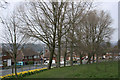
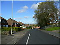
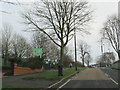
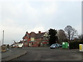
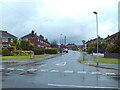
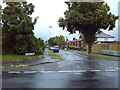
B63 4RE is a small residential postcode in England, nestled within the West Midlands. With a population of approximately 1,865, it forms part of the Belle Vale Ward in Dudley, a historically industrious area with roots stretching back to the 18th century. The postcode covers a compact cluster of homes, reflecting a mix of historic and more recent development. Daily life here is shaped by its proximity to Halesowen, a town with a legacy of industrial activity, including sawmills and timber yards that once defined the local economy. Residents benefit from a quiet, community-focused environment, with amenities within easy reach. The area’s appeal lies in its blend of practicality and heritage—historic buildings like Regency-era homes and 19th-century industrial sites coexist with modern living. For those seeking a balance between convenience and character, B63 4RE offers a distinct identity, anchored by its modest size and strong local connections. Its low crime risk and reliable digital connectivity further enhance its appeal for families and professionals alike.
- Area Type
- Postcode
- Area Size
- Not available
- Population
- 1865
- Population Density
- 5812 people/km²
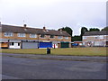
The property market in B63 4RE is dominated by owner-occupied homes, with 65% of residents living in their own properties. This high rate of home ownership suggests a stable, long-term community with limited rental activity. The area is characterised by houses rather than flats, reflecting a preference for traditional housing stock. Given the small size of the postcode, property availability is likely limited, making it a niche market for buyers seeking characterful homes. The presence of historic buildings, including Regency-era residences and 19th-century industrial structures, adds unique value to properties. However, the compact nature of the area means buyers should consider proximity to larger towns like Halesowen for additional amenities. The market is likely competitive, with properties retaining their appeal due to low crime risk and reliable digital connectivity. For those prioritising stability and heritage, B63 4RE offers a distinct opportunity.
House Prices in B63 4RE
No properties found in this postcode.
Energy Efficiency in B63 4RE
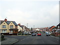
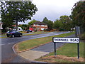
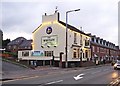
Living in B63 4RE offers a blend of practicality and local character. Residents have access to essential retail outlets, including Co-op Halesowen, Lidl Halesowen, and Tesco Hasbury, all within a short distance. The area’s rail and metro connections—Old Hill, Cradley Heath, Lye, Kenrick Park, Trinity Way, and West Bromwich Central—provide efficient commuting options to nearby towns and cities. For leisure, the proximity to Halesowen’s historic sites, such as Regency-era homes and 19th-century industrial buildings, adds cultural depth to daily life. While the area itself is small, its integration with Halesowen ensures a range of services and recreational opportunities. The presence of historic buildings, like James Grove & Sons’ Bloomfield Works, reflects a heritage that enriches the local landscape. This mix of practical amenities and historical interest creates a lifestyle that is both functional and rooted in tradition.
Amenities
Schools
| Rank | School | Type | Entry gender | Ages |
|---|
Explore more schools in this area
Go to Schools tabDemographics
The community in B63 4RE is predominantly composed of adults aged 30–64, with a median age of 47. This suggests a stable population with a focus on family-oriented living. Home ownership is high at 65%, indicating a strong presence of long-term residents. The area is characterised by houses rather than flats, reflecting a preference for traditional, spacious dwellings. The predominant ethnic group is White, aligning with broader trends in the West Midlands. The population size of 1,865 means the area is small enough to foster a close-knit community but large enough to support essential services. The age profile suggests a mature demographic, potentially with fewer young families compared to other regions. This profile may influence local amenities and services, with a focus on practical needs over youth-centric facilities. The absence of specific deprivation data means the quality of life here is likely shaped by the area’s stability, safety, and accessibility to nearby towns.
Household Size
Accommodation Type
Tenure
Ethnic Group
Religion
Household Composition
Age
Household Deprivation
NS-SEC
Explore more demographic insights in this area
Go to Demographics tabPlanning
Planning Constraints
- Flood RiskPremium
- Ramsar Wetland SitesPremium
- Area of Outstanding Natural BeautyPremium
- Protected Nature ReservePremium
- Protected WoodlandPremium