Area Overview for B63 4QL
Photos of B63 4QL
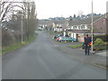
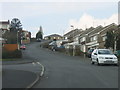
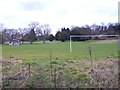
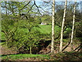
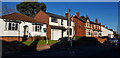
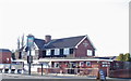
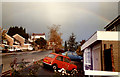
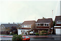
23 photos from this area
Area Information
Key information about the B63 4QL including its size, population, and administrative classification.
- Area Type
- Postcode
- Area Size
- 1.6 hectares
- Population
- 1457
- Population Density
- 3691 people/km²
House Prices in B63 4QL
51
Properties
£194,458
Average Sold Price
£60,000
Lowest Price
£320,000
Highest Price
Showing 51 properties
| Address | Type | Beds | Baths | Last Sale Price | Last Sale Date | |
|---|---|---|---|---|---|---|
| 130 Blakedown Road, Halesowen, B63 4QL | Semi-detached | 3 | 1 | £320,000 | Aug 2025 | |
| 123 Blakedown Road, Halesowen, B63 4QL | Semi-detached | 3 | 1 | £262,000 | Jan 2025 | |
| 136 Blakedown Road, Halesowen, B63 4QL | house | - | - | £279,000 | Sep 2023 | |
| 138 Blakedown Road, Halesowen, B63 4QL | Semi-detached | 3 | 1 | £285,000 | Jan 2023 | |
| 143 Blakedown Road, Halesowen, B63 4QL | Semi-detached | 3 | 1 | £270,000 | Jun 2022 | |
| 122 Blakedown Road, Halesowen, B63 4QL | house | - | - | £255,000 | Sep 2021 | |
| 145 Blakedown Road, Halesowen, B63 4QL | house | 3 | - | £272,500 | Jun 2021 | |
| 164 Blakedown Road, Halesowen, B63 4QL | house | 3 | 1 | £258,000 | Apr 2021 | |
| 148 Blakedown Road, Halesowen, B63 4QL | Semi-detached | 3 | 1 | £230,000 | Oct 2019 | |
| 128 Blakedown Road, Halesowen, B63 4QL | house | - | - | £242,000 | Sep 2019 |
Page 1 of 6
Energy Efficiency in B63 4QL
Amenities
Schools
| Rank | School | Type | Entry gender | Ages |
|---|
Explore more schools in this area
Go to Schools tabDemographics
Household Size
One person
most common
Accommodation Type
Houses
most common
Tenure
85
majority
Ethnic Group
White
most common
Religion
N/A
most common
Household Composition
N/A
most common
Age
47
median
Adults (30-64 years)
most common
Household Deprivation
N/A
with no deprivation
NS-SEC
38
in Lower managerial occupations
Explore more demographic insights in this area
Go to Demographics tabPlanning
Planning Constraints
- Flood RiskPremium
- Ramsar Wetland SitesPremium
- Area of Outstanding Natural BeautyPremium
- Protected Nature ReservePremium
- Protected WoodlandPremium