Area Overview for B63 4EJ
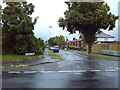
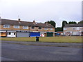
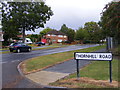
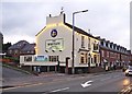
Photos of B63 4EJ
Area Information
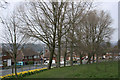
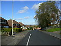
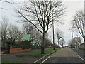
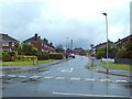
Living in B63 4EJ means residing in a small residential cluster within the historic township of Lutley, near the West Midlands/Worcestershire border. This area, part of the Hayley Green and Cradley South ward, is characterised by owner-occupied housing built between the 1930s and 1970s, with a population of 1,683. Its suburban feel is defined by proximity to farmland and green belt land, offering a quieter alternative to nearby urban centres. The area’s history includes its absorption into Halesowen and the presence of Hayley Green Hospital, which operated until the mid-1990s. Residents benefit from a mix of local amenities, including shops, rail links, and nearby natural spaces like Uffmoor Wood. The postcode’s location at the edge of the Black Country conurbation provides access to both rural tranquillity and regional connectivity. With a median age of 47 and a strong home ownership rate, B63 4EJ appeals to families and long-term residents seeking stability. Its proximity to Birmingham and Kidderminster, coupled with practical transport links, ensures it is neither isolated nor overly congested.
- Area Type
- Postcode
- Area Size
- Not available
- Population
- 1683
- Population Density
- 5190 people/km²
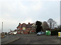
The property market in B63 4EJ is dominated by owner-occupied homes, with 76% of residents living in properties they own. This suggests a stable market with limited rental demand, as opposed to areas with higher tenant populations. The accommodation type is predominantly houses, which are typically larger and more suited to families. The area’s housing stock, built between the 1930s and 1970s, reflects a mix of older, established properties and mid-century developments. This makes B63 4EJ attractive to buyers seeking spacious, long-term homes rather than newer builds. The small residential cluster nature of the postcode means that properties are likely to be spread across a limited number of estates, such as Causey Farm or Squirrels estate. Buyers should consider the age of properties when assessing maintenance costs, though the absence of planning constraints like protected woodlands or AONB designations may simplify development or renovation processes.
House Prices in B63 4EJ
No properties found in this postcode.
Energy Efficiency in B63 4EJ
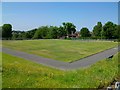
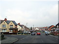
Residents of B63 4EJ have access to a range of amenities within practical reach. Retail options include Tesco Stourbridge, Co-op Halesowen, and Tesco Hasbury, providing everyday shopping convenience. The area is served by multiple railway stations, including Old Hill and Lye, and metro stops such as Kenrick Park, offering diverse transport choices. Local leisure options include Uffmoor Wood, a 300-acre ancient woodland with public access, and the Hagley Golf and Country Club for outdoor activities. The Fox Hunt public house, part of the Harvester chain, and small shops at the A456/B4183 roundabout contribute to the area’s community feel. These amenities support a balanced lifestyle, combining suburban tranquillity with proximity to urban services. The mix of green spaces, retail, and transport links ensures that daily life in B63 4EJ is both convenient and varied.
Amenities
Schools
The nearest schools to B63 4EJ include Huntingtree Primary School, a primary institution serving the local community. While the data lists this school twice, it is the only named school in the area. The presence of a primary school indicates that the area caters to families with young children, though no secondary schools are mentioned. This suggests that students may need to travel to nearby towns for secondary education. The lack of additional schools in the data means that families should investigate further to confirm the full range of educational options. The absence of specific Ofsted ratings or performance metrics means that prospective buyers should conduct their own research or consult local education authorities for detailed insights.
| Rank | School | Type | Entry gender | Ages |
|---|
Explore more schools in this area
Go to Schools tabDemographics
The community in B63 4EJ is predominantly composed of adults aged 30–64, with a median age of 47. Home ownership is high, at 76%, reflecting a stable, long-term resident population. The area is primarily composed of houses, indicating a focus on family-oriented living rather than flats or apartments. The predominant ethnic group is White, which aligns with broader trends in the West Midlands. This demographic profile suggests a mature, established community with lower turnover rates. The age range implies a mix of working-age individuals and retirees, potentially supporting local services and amenities. The absence of specific data on deprivation or diversity does not detract from the area’s character, which is defined by its suburban, owner-occupied housing stock. The population size of 1,683 ensures a close-knit environment, where familiarity with local services and social networks is likely to be strong.
Household Size
Accommodation Type
Tenure
Ethnic Group
Religion
Household Composition
Age
Household Deprivation
NS-SEC
Explore more demographic insights in this area
Go to Demographics tabPlanning
Planning Constraints
- Flood RiskPremium
- Ramsar Wetland SitesPremium
- Area of Outstanding Natural BeautyPremium
- Protected Nature ReservePremium
- Protected WoodlandPremium