Area Overview for B63 4BD
Photos of B63 4BD
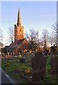
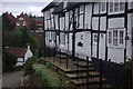
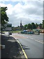
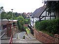
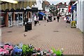
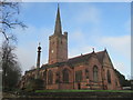
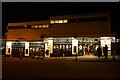
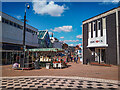
53 photos from this area
Area Information
Key information about the B63 4BD including its size, population, and administrative classification.
- Area Type
- Postcode
- Area Size
- 1.1 hectares
- Population
- 1580
- Population Density
- 1194 people/km²
House Prices in B63 4BD
31
Properties
£152,216
Average Sold Price
£43,000
Lowest Price
£265,000
Highest Price
Showing 31 properties
| Address | Type | Beds | Baths | Last Sale Price | Last Sale Date | |
|---|---|---|---|---|---|---|
| 52 Richmond Street, Halesowen, B63 4BD | house | 3 | - | £233,000 | Apr 2025 | |
| 96 Richmond Street, Halesowen, B63 4BD | Semi-detached | 3 | 1 | £130,000 | Jul 2023 | |
| 106 Richmond Street, Halesowen, B63 4BD | Retail | 3 | 1 | £265,000 | Oct 2022 | |
| 72 Richmond Street, Halesowen, B63 4BD | house | - | - | £227,500 | Sep 2021 | |
| 102 Richmond Street, Halesowen, B63 4BD | house | - | - | £245,000 | Aug 2021 | |
| 88 Richmond Street, Halesowen, B63 4BD | Semi-detached | 3 | 1 | £175,000 | Jun 2019 | |
| 40 Richmond Street, Halesowen, B63 4BD | Terraced | 2 | 1 | £151,950 | Jun 2018 | |
| 38 Richmond Street, Halesowen, B63 4BD | Terraced | 2 | 1 | £128,000 | Apr 2018 | |
| 90 Richmond Street, Halesowen, B63 4BD | house | - | - | £164,000 | Jul 2016 | |
| 36 Richmond Street, Halesowen, B63 4BD | Terraced | 2 | 1 | £124,000 | Jul 2016 |
Page 1 of 4
Energy Efficiency in B63 4BD
Amenities
Schools
| Rank | School | Type | Entry gender | Ages |
|---|
Explore more schools in this area
Go to Schools tabDemographics
Household Size
One person
most common
Accommodation Type
Houses
most common
Tenure
65
majority
Ethnic Group
White
most common
Religion
N/A
most common
Household Composition
N/A
most common
Age
47
median
Adults (30-64 years)
most common
Household Deprivation
N/A
with no deprivation
NS-SEC
27
in Lower managerial occupations
Explore more demographic insights in this area
Go to Demographics tabPlanning
Planning Constraints
- Flood RiskPremium
- Ramsar Wetland SitesPremium
- Area of Outstanding Natural BeautyPremium
- Protected Nature ReservePremium
- Protected WoodlandPremium