Area Overview for B63 3UU
Photos of B63 3UU
Area Information
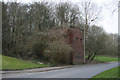
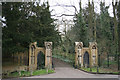
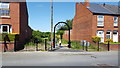
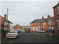
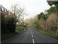
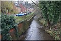
Living in B63 3UU offers a settled residential experience within the metropolitan borough of Dudley. This specific postcode area defines a small residential cluster with a recorded population of 1519 people. The location sits firmly within the Halesowen region, an area that has formed part of the West Midlands since the 1974 local government reorganisation. Archaeological records indicate evidence of settlement here dating back to at least the 18th century. The neighbourhood retains historic fabric from this period and features buildings with origins reaching into the medieval era. Residents enjoy proximity to significant industrial landmarks that define the local heritage. James Grove and Sons Bloomfield Works on Stourbridge Road stands as a notable feature, containing components from approximately 1862. A late 19th century sawmill building documented as existing by 1888 adds to the area's character. A Regency period gentleman's residence also features in the ward, having undergone substantial alterations while retaining original character. Life here balances access to modern convenience with a neighbourhood built on deep historical roots.
- Area Type
- Postcode
- Area Size
- Not available
- Population
- 1519
- Population Density
- 4199 people/km²
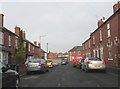
The property market in B63 3UU is dominated by owner-occupation, driven largely by the high rate of homeownership at 67%. Houses account for the vast majority of accommodation types available in this specific residential cluster. This indicates that the local housing stock consists primarily of freehold or leasehold dwellings suited for family life. The area represents a small residential cluster where buyers generally find established properties rather than new builds or样板楼s. For prospective homebuyers, this environment suggests a market less volatile than high-density rental zones. The data shows that residents have chosen to settle into houses within B63 3UU, creating a consistent demand for traditional UK housing styles. When viewing homes in this area, purchasers should expect to engage with owners rather than landlords. The mix of historic buildings, including a Regency gentlemen's residence and structures from the late 19th century, adds variety to the property listings. This stability makes the area attractive to those seeking long-term residence rather than short-term letting arrangements.
House Prices in B63 3UU
No properties found in this postcode.
Energy Efficiency in B63 3UU
Daily life in B63 3UU benefits from convenient access to nearby amenities without requiring a lengthy journey. Residents have five retail options immediately reachable, including Tesco Stourbridge, Heron Halesowen, and Lidl Halesowen. These supermarkets cover everyday shopping needs from groceries to household essentials. Transport links are equally well-developed with five railway stations within practical reach. Old Hill Railway Station, Cradley Heath Railway Station, and Lye Railway Station connect households to wider networks. Frequent commuters also benefit from five metro travel hubs available nearby. Kenrick Park, Trinity Way, and West Bromwich Central serve as key transit points. This density of transport choices gives you flexibility in choosing your daily commute route. You have multiple options to avoid gridlock and find a service that fits your schedule. The combination of strong retail provision and diverse transport links creates a practical lifestyle. Homes in B63 3UU sit well within a network that supports both leisure and business travel.
Amenities
Schools
| Rank | School | Type | Entry gender | Ages |
|---|
Explore more schools in this area
Go to Schools tabDemographics
The community in B63 3UU reflects a mature neighbourhood with a median age of 47 years. Adults aged between 30 and 64 years represent the most common age range within the population. This demographic profile suggests a family-friendly environment where households are likely established rather than transient. Home ownership is high, with 67% of residents owning their homes outright or with a mortgage. The remaining ownership structure implies a significant rental sector for those not yet settled. Houses comprise the primary accommodation type throughout this postcode area. This preference for detached or semi-detached properties contrasts with the prevalence of flats found in larger urban centres. The predominant ethnic group is White, aligning with the broader demographic trends of the surrounding West Midlands region. The concentration of homeowners indicates a stable社群 where residents have invested in their local addresses. This ownership level typically correlates with lower turnover rates compared to private rental sectors.
Household Size
Accommodation Type
Tenure
Ethnic Group
Religion
Household Composition
Age
Household Deprivation
NS-SEC
Explore more demographic insights in this area
Go to Demographics tabPlanning
Planning Constraints
- Flood RiskPremium
- Ramsar Wetland SitesPremium
- Area of Outstanding Natural BeautyPremium
- Protected Nature ReservePremium
- Protected WoodlandPremium