Area Overview for B63 3TN
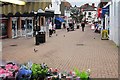
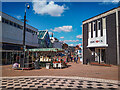
Photos of B63 3TN
Area Information
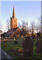
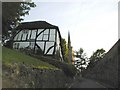
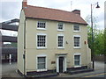
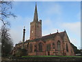
Living in B63 3TN means inhabiting a small, densely populated residential cluster in the heart of Halesowen, Dudley. With 1,580 residents spread across 1.32 km², the area reflects a compact, community-focused lifestyle. The median age of 47 suggests a mature demographic, with most residents aged 30–64, indicating a stable population of working-age adults and families. The area’s history is rooted in 18th-century settlements and industrial heritage, including historic buildings like a Regency gentleman’s residence and the Bloomfield Works sawmill, which operated from the 1860s. Today, the postcode is served by a mix of retail, transport, and educational facilities, making it practical for daily life. While the population density is high, the area’s proximity to rail networks and nearby amenities offers convenience. However, the high crime risk score of 21/100 underscores the need for caution, balancing the area’s otherwise accessible and historically rich character.
- Area Type
- Postcode
- Area Size
- Not available
- Population
- 1580
- Population Density
- 1194 people/km²
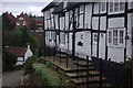
The property market in B63 3TN is characterised by a high rate of home ownership (65%) and a predominance of houses over flats or other accommodation types. This suggests a residential area with larger, family-friendly homes rather than a rental-focused market. The compact size of the postcode, combined with its high population density, implies that property availability is limited, and the housing stock is likely to be mature, with many homes dating back to the 19th or 20th centuries. For buyers, this means a focus on established properties rather than new developments. The area’s proximity to schools, retail, and transport links may enhance its appeal, though the high crime risk score of 21/100 could deter some buyers. Those considering the area should weigh the stability of home ownership against the potential challenges of living in a densely populated, historically industrialised neighbourhood.
House Prices in B63 3TN
No properties found in this postcode.
Energy Efficiency in B63 3TN
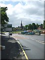
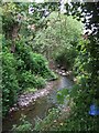
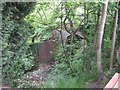
The lifestyle in B63 3TN is shaped by its proximity to retail, transport, and community hubs. Within practical reach are supermarkets like Tesco Stourbridge and Aldi Halesowen, alongside smaller shops such as Heron Halesowen. The area’s rail and metro stations—Old Hill, Cradley Heath, and Rowley Regis—offer frequent services to nearby towns, while the metro stops at Kenrick Park and West Bromwich Central provide additional connectivity. Though specific parks or leisure facilities are not detailed in the data, the historical industrial sites, such as the Bloomfield Works, hint at a blend of heritage and practical amenities. The combination of retail options and transport links makes daily life convenient, though the high crime risk score of 21/100 suggests residents should remain vigilant about personal safety.
Amenities
Schools
Residents of B63 3TN have access to a range of educational institutions, including primary and secondary schools. Newfield Park Primary School and Halesowen CofE Primary School both offer primary education, with the latter holding a ‘good’ Ofsted rating. The Earls High School, listed as both a primary and academy school, also carries a ‘good’ Ofsted rating, indicating quality teaching and facilities. For sixth-form education, Halesowen College provides further study options. The mix of school types ensures families can access primary, secondary, and post-16 education within the area, reducing the need for long commutes. However, the absence of data on school catchment areas or pupil performance means prospective buyers should verify suitability for their children’s needs independently.
| Rank | School | Type | Entry gender | Ages |
|---|
Explore more schools in this area
Go to Schools tabDemographics
B63 3TN’s population of 1,580 is predominantly composed of adults aged 30–64, with a median age of 47. This suggests a community of established professionals and families, rather than a younger or elderly demographic. Home ownership is strong, with 65% of residents owning their homes, compared to 35% renting. The accommodation type is largely houses, reflecting a suburban or semi-rural character. The predominant ethnic group is White, though specific data on diversity is not provided. The area’s population density of 1,194 people per km² indicates a tightly packed residential cluster, which may influence community dynamics and local services. While no explicit data on deprivation is available, the high home ownership rate and stable age profile suggest a relatively stable socioeconomic environment, though the high crime risk score of 21/100 complicates this picture.
Household Size
Accommodation Type
Tenure
Ethnic Group
Religion
Household Composition
Age
Household Deprivation
NS-SEC
Explore more demographic insights in this area
Go to Demographics tabPlanning
Planning Constraints
- Flood RiskPremium
- Ramsar Wetland SitesPremium
- Area of Outstanding Natural BeautyPremium
- Protected Nature ReservePremium
- Protected WoodlandPremium