Area Overview for B63 3SP
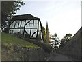
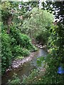
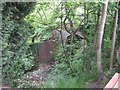
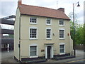
Photos of B63 3SP
Area Information
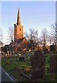
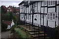
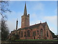
B63 3SP is a small, residential postcode area nestled within the Dudley Metropolitan Borough, part of the broader Halesowen region in the West Midlands. With a population of 1,443, it reflects the suburban character of the Black Country, where historical roots meet modern convenience. The area’s compact size fosters a tight-knit community, though its proximity to major transport routes and amenities ensures accessibility. Halesowen itself, historically an exclave of Shropshire, has evolved into a suburban hub with a mix of traditional and contemporary features. Residents benefit from nearby green spaces like the Leasowes, a public park with 18th-century landscape design, and proximity to Halesowen Abbey ruins, a listed heritage site. Daily life here balances quiet residential living with practical connectivity, including multiple railway stations and retail options. The area’s median age of 47 suggests a stable, family-oriented demographic, with a strong emphasis on home ownership. For buyers, B63 3SP offers a blend of low flood risk and moderate crime rates, though its small scale means limited housing stock and a focus on established properties.
- Area Type
- Postcode
- Area Size
- Not available
- Population
- 1443
- Population Density
- 3114 people/km²
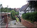
B63 3SP is primarily an owner-occupied area, with 76% of homes owned by residents rather than rented. The accommodation type is predominantly houses, which is typical for suburban areas in the West Midlands. This suggests a market focused on family homes rather than apartments or investment properties. Given the small postcode area, the housing stock is likely limited, with limited scope for new developments. Buyers should consider that the area’s compact size may mean fewer options for property types or price ranges. The high home ownership rate indicates a stable market, but it also means competition for available listings. For those seeking rental properties, the data does not suggest a strong secondary market, so buyers should approach the area with realistic expectations about availability and potential for growth.
House Prices in B63 3SP
No properties found in this postcode.
Energy Efficiency in B63 3SP
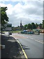
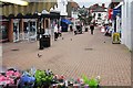
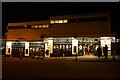
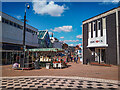
Residents of B63 3SP have access to a range of amenities within practical reach. Retail options include Iceland, Lidl, and Heron in Halesowen, providing everyday shopping convenience. The area’s transport links, including railway and metro stations, connect to broader networks for dining, leisure, and employment. Nearby green spaces like the Leasowes, a 57-hectare public park with 18th-century landscapes, offer recreational opportunities. The historical Halesowen Abbey ruins add cultural value, though no specific leisure venues are listed. The mix of retail, transport, and green space supports a balanced lifestyle, with shops and transport within walking or short driving distance. While the area’s small size limits diversity in amenities, its proximity to Halesowen’s broader offerings compensates, making it suitable for those prioritising convenience over extensive choice.
Amenities
Schools
B63 3SP is served by several primary schools, including Tenterfields Primary School, Manor Way Primary School, and Tenterfields Primary Academy, which both have Ofsted ratings of ‘good’. Manor Way Primary Academy also holds a ‘good’ rating. The area includes a special school, The Mount School, catering to specific educational needs. This mix of mainstream and specialist provision offers families a range of options, from standard primary education to tailored support. The presence of multiple schools within proximity suggests a focus on local education, though no secondary schools are listed in the data. For parents, the ‘good’ Ofsted ratings indicate reliable standards, but the absence of secondary schools may require commuting for older children. The density of primary schools also supports the area’s family-oriented demographic.
| Rank | School | Type | Entry gender | Ages |
|---|
Explore more schools in this area
Go to Schools tabDemographics
The population of B63 3SP is 1,443, with a median age of 47, indicating a mature demographic skewed toward adults aged 30–64. This age range suggests a community with established careers and family structures, likely contributing to the 76% home ownership rate. The accommodation type is predominantly houses, reflecting a preference for single-family dwellings over flats or apartments. The predominant ethnic group is White, though specific diversity metrics are not provided. The age profile aligns with a low proportion of young families or retirees, which may influence local services and amenities. With no data on deprivation levels, the focus remains on the stability of a community where most residents own their homes. This demographic profile suggests a relatively quiet, settled area with limited turnover in housing, which could appeal to buyers seeking long-term residency.
Household Size
Accommodation Type
Tenure
Ethnic Group
Religion
Household Composition
Age
Household Deprivation
NS-SEC
Explore more demographic insights in this area
Go to Demographics tabPlanning
Planning Constraints
- Flood RiskPremium
- Ramsar Wetland SitesPremium
- Area of Outstanding Natural BeautyPremium
- Protected Nature ReservePremium
- Protected WoodlandPremium