Area Overview for B63 3SL
Photos of B63 3SL
Area Information
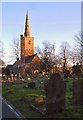
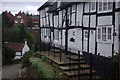
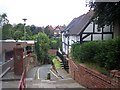
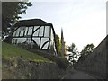
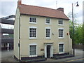
Living in B63 3SL means inhabiting a compact residential cluster in the heart of Dudley, West Midlands. The area covers just 4 hectares, housing 1,580 people in a densely populated space with 1,194 residents per square kilometre. This postcode lies within the historic Belle Vale Ward, part of Halesowen since the 1974 local government reforms. Daily life here is shaped by its proximity to industrial heritage, with 18th- and 19th-century buildings still standing. The community is predominantly middle-aged, with a median age of 47, and households are largely owner-occupied. This small area blends modern convenience with historical roots, offering a quiet yet connected existence. Residents benefit from nearby schools, retail, and transport links, though the compact size means the immediate surroundings are key to daily life. The area’s character is defined by its mix of residential stability and the legacy of past industries, making it a distinct pocket within a larger urban framework.
- Area Type
- Postcode
- Area Size
- 4.0 hectares
- Population
- 1580
- Population Density
- 1194 people/km²
The property market in B63 3SL is characterised by a high rate of home ownership—65% of residents own their homes. This suggests a stable, long-term community with limited rental activity. The primary accommodation type is houses, which is typical for a small, residential postcode area. Given the compact size of B63 3SL, the housing stock is likely limited to a few dozen properties, with little scope for expansion. Buyers should consider that the area’s immediate surroundings, rather than the postcode itself, may offer more options. The focus on owner-occupied homes indicates that property values may be influenced by local amenities, such as schools and transport links. However, the small size of the area means that proximity to nearby towns and services is crucial for residents seeking more housing choices.
House Prices in B63 3SL
Showing 2 properties
| Address | Type | Beds | Baths | Last Sale Price | Last Sale Date | |
|---|---|---|---|---|---|---|
| Tennis 49M From The Earls High School, Furnace Lane 75M From Furnace Lane, Furnace Lane, Halesowen, B63 3SL | Leisure | - | - | - | - | |
| Earls Gymnastic And Dance Centre, The Earls High School, Furnace Lane, Halesowen, B63 3SL | house | - | - | - | - |
Energy Efficiency in B63 3SL
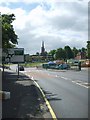
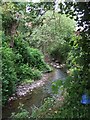
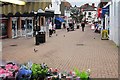
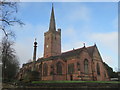
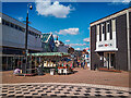
Residents of B63 3SL enjoy a mix of retail, transport, and leisure options within practical reach. The area’s retail landscape includes Aldi Halesowen, Iceland Halesowen, and Heron Halesowen, providing grocery and convenience shopping. Nearby rail stations—Old Hill, Rowley Regis, and Cradley Heath—connect to Birmingham and surrounding towns, while metro stops at Kenrick Park, Trinity Way, and West Bromwich Central offer local mobility. For leisure, the proximity to Halesowen’s historic and industrial sites, such as the 18th-century buildings and Bloomfield Works, adds character to daily life. Though parks and green spaces are not explicitly listed, the area’s compact size ensures that residents can access nearby open spaces within a short walk or drive. The blend of practical amenities and historical context creates a lifestyle that balances convenience with a sense of place.
Amenities
Schools
Residents of B63 3SL have access to a range of educational institutions, including primary schools and a sixth-form college. Newfield Park Primary School and Halesowen CofE Primary School, both rated ‘good’ by Ofsted, serve younger children, while The Earls High School, an academy also rated ‘good’, provides secondary education. Halesowen College offers further education for sixth-form students. The mix of school types ensures that families can access both state and specialist provision. The presence of a sixth-form college within the area is a significant advantage for students seeking post-16 education without commuting. However, the absence of higher education institutions nearby means that university-bound students may need to travel further. The quality ratings of the primary and secondary schools suggest a reliable educational foundation for children in the area.
| Rank | School | Type | Entry gender | Ages |
|---|
Explore more schools in this area
Go to Schools tabDemographics
The population of B63 3SL is 1,580, with a median age of 47, reflecting a community dominated by adults aged 30–64. Home ownership rates are high at 65%, indicating a stable, long-term resident base. The majority of accommodation is in houses, rather than flats, which aligns with the area’s low population density relative to its size. The predominant ethnic group is White, though no specific diversity statistics are provided. The age profile suggests a mature demographic, with fewer young families or retirees compared to other areas. This balance of age and tenure creates a community focused on established living, with limited turnover. The high home ownership rate also implies lower rental availability, which may affect housing choices for those seeking temporary accommodation. The compact size of the area means that social networks and local services are tightly woven into daily life.
Household Size
Accommodation Type
Tenure
Ethnic Group
Religion
Household Composition
Age
Household Deprivation
NS-SEC
Explore more demographic insights in this area
Go to Demographics tabPlanning
Planning Constraints
- Flood RiskPremium
- Ramsar Wetland SitesPremium
- Area of Outstanding Natural BeautyPremium
- Protected Nature ReservePremium
- Protected WoodlandPremium