Area Overview for B63 3QS
Photos of B63 3QS
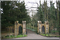
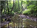
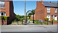
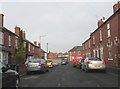
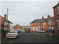
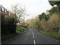
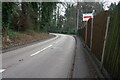
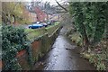
36 photos from this area
Area Information
Key information about the B63 3QS including its size, population, and administrative classification.
- Area Type
- Postcode
- Area Size
- 2.1 hectares
- Population
- 1519
- Population Density
- 4199 people/km²
House Prices in B63 3QS
24
Properties
£186,079
Average Sold Price
£70,000
Lowest Price
£287,000
Highest Price
Showing 24 properties
| Address | Type | Beds | Baths | Last Sale Price | Last Sale Date | |
|---|---|---|---|---|---|---|
| 356 Stourbridge Road, Halesowen, B63 3QS | Semi-detached | 3 | 1 | £275,000 | Mar 2025 | |
| 386 Stourbridge Road, Halesowen, B63 3QS | house | 3 | 1 | £287,000 | Mar 2024 | |
| 338 Stourbridge Road, Halesowen, B63 3QS | Semi-detached | 3 | 1 | £230,000 | Mar 2021 | |
| 382 Stourbridge Road, Halesowen, B63 3QS | house | - | - | £235,000 | Dec 2020 | |
| 362 Stourbridge Road, Halesowen, B63 3QS | house | - | - | £217,000 | Nov 2018 | |
| 364 Stourbridge Road, Halesowen, B63 3QS | Detached | 3 | 1 | £240,000 | Jul 2018 | |
| 376 Stourbridge Road, Halesowen, B63 3QS | Semi-detached | 3 | - | £187,950 | Feb 2017 | |
| 344 Stourbridge Road, Halesowen, B63 3QS | Semi-detached | 5 | 3 | £190,000 | Jul 2009 | |
| 384 Stourbridge Road, Halesowen, B63 3QS | Semi-detached | - | - | £90,000 | Aug 2002 | |
| 340 Stourbridge Road, Halesowen, B63 3QS | Semi-detached | - | - | £77,000 | Aug 2002 |
Page 1 of 3
Energy Efficiency in B63 3QS
Amenities
Schools
| Rank | School | Type | Entry gender | Ages |
|---|
Explore more schools in this area
Go to Schools tabDemographics
Household Size
Two person
most common
Accommodation Type
Houses
most common
Tenure
67
majority
Ethnic Group
White
most common
Religion
N/A
most common
Household Composition
N/A
most common
Age
47
median
Adults (30-64 years)
most common
Household Deprivation
N/A
with no deprivation
NS-SEC
32
in Lower managerial occupations
Explore more demographic insights in this area
Go to Demographics tabPlanning
Planning Constraints
- Flood RiskPremium
- Ramsar Wetland SitesPremium
- Area of Outstanding Natural BeautyPremium
- Protected Nature ReservePremium
- Protected WoodlandPremium