Area Overview for B63 3NU
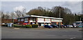
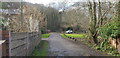
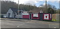
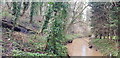
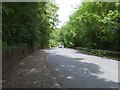
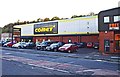
Photos of B63 3NU

Area Information
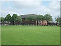
Living in B63 3NU means residing in a compact residential cluster within the Metropolitan Borough of Dudley, part of Halesowen’s historic civil parish. The area’s population of 1,580 is spread across a dense 1.33 km², reflecting a tightly knit community. With a median age of 47, the area is predominantly home to adults aged 30–64, suggesting a stable, established demographic. Its roots trace back to the 18th century, with industrial and agricultural legacies still evident in structures like the Regency-era gentleman’s residence and the Bloomfield Works sawmill. Daily life here balances proximity to retail, transport, and schools with the quiet character of a small town. Residents benefit from excellent broadband connectivity and nearby rail links, though crime rates are notably high. The area’s mix of historic buildings and modern amenities creates a unique blend of tradition and practicality, appealing to those seeking a settled, community-focused environment.
- Area Type
- Postcode
- Area Size
- Not available
- Population
- 1580
- Population Density
- 1194 people/km²
The property market in B63 3NU is dominated by owner-occupied homes, with 65% of residents living in properties they own. The accommodation type is predominantly houses, which is unusual for urban areas and suggests a suburban or semi-rural character. This mix of home ownership and house-based living indicates a community prioritising private, long-term residency over rental properties. The small area’s limited size means property choices are constrained, but the proximity to amenities like schools and transport hubs may enhance desirability. For buyers, this suggests a market where properties are likely to be family homes rather than investment opportunities, with potential for stability but limited scope for speculative growth. The lack of rental data means the extent of the rental market remains unclear, though the high home ownership rate implies a lower proportion of rental properties.
House Prices in B63 3NU
No properties found in this postcode.
Energy Efficiency in B63 3NU
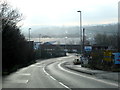
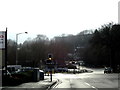
The lifestyle in B63 3NU is shaped by its proximity to retail, transport, and community hubs. Nearby shops include Tesco Dudley, Aldi Halesowen, and Makro Birmingham, offering convenience for daily needs. Rail stations like Old Hill and Cradley Heath provide easy access to wider networks, while metro stops at Kenrick Park and Trinity Way link to urban centres. The area’s historic buildings and industrial heritage contribute to a distinct character, though modern amenities ensure practicality. For families, the mix of schools and transport options supports a balanced life, while the dense population density suggests a vibrant, active community. The presence of retail and transport infrastructure means daily errands and travel are efficient, though the small area’s size means social and leisure options are limited to nearby towns.
Amenities
Schools
Residents of B63 3NU have access to a range of educational institutions, including Newfield Park Primary School and Halesowen CofE Primary School, both of which serve younger children. The Earls High School functions as both a primary and academy school, with an Ofsted rating of “good,” indicating a reliable standard of education. Halesowen College provides sixth-form education, catering to older students. The mix of primary, academy, and post-16 education options ensures families can plan for schooling from early years through to higher education. The presence of a “good”-rated school in the area may be a key draw for families, though the absence of data on secondary school performance or pupil outcomes means the full educational landscape remains partially defined.
| Rank | School | Type | Entry gender | Ages |
|---|
Explore more schools in this area
Go to Schools tabDemographics
B63 3NU’s population is overwhelmingly composed of adults aged 30–64, with a median age of 47. This suggests a mature, stable community, likely with strong family ties and established careers. Home ownership stands at 65%, indicating a majority of residents live in properties they own, rather than renting. The accommodation type is primarily houses, which aligns with the area’s residential character. The predominant ethnic group is White, though no specific data on diversity or deprivation is provided. This demographic profile implies a focus on long-term residency and community continuity, with fewer transient populations. The absence of specific data on income or deprivation means the area’s economic profile remains opaque, but the high home ownership rate suggests a degree of financial stability among residents.
Household Size
Accommodation Type
Tenure
Ethnic Group
Religion
Household Composition
Age
Household Deprivation
NS-SEC
Explore more demographic insights in this area
Go to Demographics tabPlanning
Planning Constraints
- Flood RiskPremium
- Ramsar Wetland SitesPremium
- Area of Outstanding Natural BeautyPremium
- Protected Nature ReservePremium
- Protected WoodlandPremium