Area Overview for B63 3HW
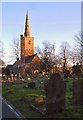
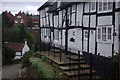
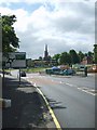
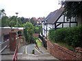
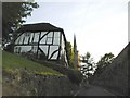
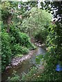
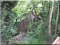
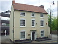
Photos of B63 3HW
Area Information
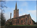
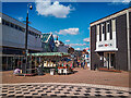
Living in B63 3HW means being part of a small, tightly knit residential cluster in the Dudley Metropolitan Borough. With a population of 1,849, this area reflects the suburban character of Halesowen, a historically significant town once part of Shropshire. The postcode sits within a broader urban landscape of the Black Country, where modern infrastructure meets historical roots. Daily life here is shaped by proximity to essential services, including retail hubs, rail networks, and community amenities. The area’s compact size means residents can access nearby attractions such as Halesowen Abbey ruins and the Leasowes public park, blending practicality with heritage. While the population is modest, the area’s integration into regional transport links, including multiple railway stations and metro stops, ensures connectivity to larger cities like Birmingham. This makes B63 3HW appealing to those seeking a balance between quiet residential living and urban accessibility.
- Area Type
- Postcode
- Area Size
- Not available
- Population
- 1849
- Population Density
- 6637 people/km²
The property market in B63 3HW is characterised by a low home ownership rate of 19%, suggesting that the majority of housing is rented rather than owner-occupied. The predominant accommodation type is flats, which aligns with the area’s compact residential layout. This configuration may appeal to those seeking affordable, managed housing but could limit options for buyers seeking larger properties or long-term investment. The small size of the postcode area means the housing stock is likely concentrated in a limited number of developments, potentially reducing competition for properties. However, the low ownership rate may also indicate a reliance on rental income, which could affect property values and desirability for buyers. Those considering the area should assess whether the available flats meet their needs, particularly if they prioritise ownership or family-sized homes.
House Prices in B63 3HW
No properties found in this postcode.
Energy Efficiency in B63 3HW
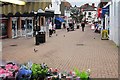
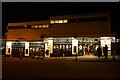
Life in B63 3HW is supported by a range of nearby amenities, including retail stores, transport hubs, and green spaces. The area’s retail offerings include Iceland Halesowen, Heron Halesowen, and Aldi Halesowen, providing access to groceries and household essentials. For transport, residents can use railway stations such as Old Hill and Rowley Regis, as well as metro stops like Kenrick Park, which connect to broader regional networks. The proximity to the Leasowes public park, a 57-hectare space with historical landscape features, offers recreational opportunities. While the data does not list dining or leisure venues explicitly, the area’s integration into Halesowen’s suburban fabric suggests a mix of local services. The combination of practical amenities and nearby natural spaces creates a lifestyle that balances convenience with access to open space.
Amenities
Schools
The nearest school to B63 3HW is Our Lady and St Kenelm RC School, a primary school with a good Ofsted rating. This institution serves the local community, offering education for younger children in a setting that combines religious and academic focus. The presence of a primary school with a good rating is a key consideration for families, though the data does not include secondary schools or further education institutions in the immediate area. The single school listed reflects the area’s small size and suggests that families may need to travel to nearby towns for secondary education. The quality of the primary school, however, provides a foundation for early learning and could be a deciding factor for homebuyers prioritising family-friendly amenities.
| Rank | School | Type | Entry gender | Ages |
|---|
Explore more schools in this area
Go to Schools tabDemographics
The community in B63 3HW is predominantly middle-aged, with a median age of 47 and the most common age range being adults aged 30–64. Home ownership is low, at 19%, suggesting a rental-dominated market. The area’s accommodation is largely flats, reflecting a focus on multi-unit housing. The predominant ethnic group is White, though specific data on diversity beyond this is not provided. With a population of 1,849, the area is small enough to foster a close-knit environment but integrated into the larger Halesowen and Dudley networks. The age profile indicates a mature population, which may influence local services and amenities. The low home ownership rate could indicate a transient population or a focus on rental properties, affecting the area’s long-term stability and community dynamics.
Household Size
Accommodation Type
Tenure
Ethnic Group
Religion
Household Composition
Age
Household Deprivation
NS-SEC
Explore more demographic insights in this area
Go to Demographics tabPlanning
Planning Constraints
- Flood RiskPremium
- Ramsar Wetland SitesPremium
- Area of Outstanding Natural BeautyPremium
- Protected Nature ReservePremium
- Protected WoodlandPremium