Area Overview for B63 3FP
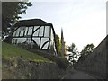
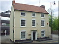
Photos of B63 3FP
Area Information
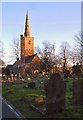
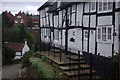
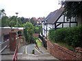
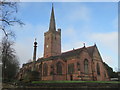
Living in B63 3FP means inhabiting a small, densely populated residential cluster in the Metropolitan Borough of Dudley. With a population of 1,580 and a density of 1,194 people per square kilometre, the area feels compact yet connected. Situated in Halesowen, it is part of a region with a history stretching back to the 18th century, marked by industrial heritage and historic buildings. The postcode’s proximity to notable sites like James Grove & Sons’ Bloomfield Works and Regency-era residences adds a layer of historical interest. Daily life here is shaped by its community-focused layout, with local amenities and transport links within reach. While the area lacks natural beauty designations, its practicality and accessibility make it a viable choice for those prioritising convenience over scenic surroundings. The mix of older homes and modern infrastructure reflects a balance between tradition and contemporary living.
- Area Type
- Postcode
- Area Size
- Not available
- Population
- 1580
- Population Density
- 1194 people/km²
The property market in B63 3FP is characterised by a high rate of home ownership (65%), with houses being the predominant accommodation type. This suggests a community of long-term residents rather than a transient rental market. The small residential cluster means properties are likely to be closely spaced, with limited scope for large-scale development. Buyers should expect a mix of older homes, some with historic features, alongside more modern builds. The high home ownership rate indicates strong local attachment, but it also means competition for available properties could be fierce. For those seeking a home, the area offers a blend of traditional housing stock and practical living spaces, though the small size of the postcode may limit options for buyers seeking specific features or larger properties.
House Prices in B63 3FP
No properties found in this postcode.
Energy Efficiency in B63 3FP
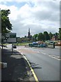
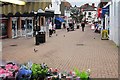
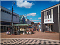
The lifestyle in B63 3FP is shaped by its proximity to retail hubs such as Tesco Stourbridge, Aldi Halesowen, and Heron Halesowen, offering everyday shopping needs. Parks and open spaces are not explicitly detailed in the data, but the area’s industrial heritage suggests a mix of urban and semi-rural environments. The presence of railway stations and metro links ensures easy access to leisure opportunities in nearby towns. The community’s character is defined by its historic buildings and established residential fabric, creating a sense of continuity. While the area lacks detailed information on dining or cultural venues, its transport links and retail options support a practical, family-oriented lifestyle.
Amenities
Schools
Residents of B63 3FP have access to a range of schools, including Newfield Park Primary School and Halesowen CofE Primary School, both of which are rated ‘good’ by Ofsted. The Earls High School serves as a primary and academy school, offering continuity for families. Halesowen College provides sixth-form education, making the area suitable for students transitioning to higher education. The variety of school types ensures options for different educational needs, from early years to post-16 studies. The presence of multiple schools within proximity reduces the need for long commutes, a key consideration for families. However, the absence of secondary school data means parents may need to look further afield for comprehensive secondary education.
| Rank | School | Type | Entry gender | Ages |
|---|
Explore more schools in this area
Go to Schools tabDemographics
The community in B63 3FP is predominantly middle-aged, with a median age of 47 and the most common age range being adults aged 30–64. Home ownership is strong, with 65% of residents living in their own homes, while the majority of properties are houses rather than flats. The predominant ethnic group is White, reflecting the area’s demographic makeup. This suggests a stable, long-term resident base with established family ties. The absence of specific deprivation data means the area’s quality of life is not explicitly tied to economic hardship, though the high home ownership rate indicates financial stability for many. The age profile suggests a mature population, which may influence local services and amenities tailored to adults rather than younger families.
Household Size
Accommodation Type
Tenure
Ethnic Group
Religion
Household Composition
Age
Household Deprivation
NS-SEC
Explore more demographic insights in this area
Go to Demographics tabPlanning
Planning Constraints
- Flood RiskPremium
- Ramsar Wetland SitesPremium
- Area of Outstanding Natural BeautyPremium
- Protected Nature ReservePremium
- Protected WoodlandPremium