Area Overview for B63 3FE
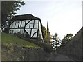
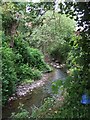
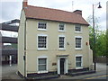
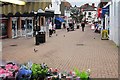
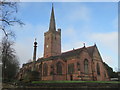
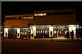
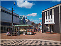
Photos of B63 3FE
Area Information
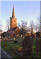
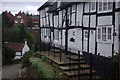
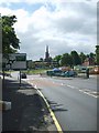
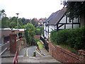
Living in B63 3FE means inhabiting a compact, residential cluster in the heart of Halesowen, part of Dudley’s Metropolitan Borough. With a population of 1,580 and a density of 1,194 people per square kilometre, this area is tightly knit, reflecting its historical roots as a 18th-century settlement. The ward, known as Belle Vale, sits within a region shaped by industrial and agricultural development, with remnants of Regency-era homes and 19th-century sawmills still visible. Daily life here balances modern convenience with a touch of heritage. Residents benefit from proximity to retail hubs like Tesco Stourbridge and Aldi Halesowen, while rail links to Old Hill and Cradley Heath stations provide easy access to nearby towns. The community, predominantly adults aged 30–64, leans towards home ownership, with 65% of properties occupied by their owners. Schools like Halesowen CofE Primary and The Earls High School add to the area’s appeal, offering a mix of primary and secondary education with good Ofsted ratings. Despite its small size, B63 3FE offers a blend of practicality and character, ideal for those seeking a connected, family-oriented lifestyle.
- Area Type
- Postcode
- Area Size
- Not available
- Population
- 1580
- Population Density
- 1194 people/km²
The property market in B63 3FE is characterised by a high rate of home ownership, with 65% of properties occupied by their owners. This suggests a stable, long-term resident base rather than a rental-heavy market. The predominant accommodation type is houses, which is unusual for a small postcode area but indicates a focus on family-sized homes. Given the compact nature of the area, the housing stock is limited, meaning buyers may need to consider nearby postcode clusters for more options. The presence of houses rather than flats or apartments implies a preference for private, spacious living, which may appeal to those seeking traditional family homes. However, the small size of B63 3FE means the property market is niche, with limited scope for new developments. For buyers, this translates to a need to scrutinise each listing closely, as the available stock is constrained by the area’s physical boundaries and historical land use patterns.
House Prices in B63 3FE
No properties found in this postcode.
Energy Efficiency in B63 3FE
The lifestyle in B63 3FE is shaped by its proximity to retail, transport, and historical sites. Residents have easy access to supermarkets like Tesco Stourbridge and Aldi Halesowen, ensuring daily shopping needs are met without long commutes. The area’s rail and metro links, including Old Hill and West Bromwich Central stations, provide seamless access to nearby towns and employment centres. Historically, the ward has been influenced by industrial activity, with remnants like James Grove & Sons’ Bloomfield Works reflecting its past. While modern amenities dominate, the presence of historic buildings adds a layer of character to the area. Parks and open spaces are not explicitly mentioned, but the compact nature of the postcode suggests a focus on urban living. For those prioritising convenience and connectivity, B63 3FE offers a blend of practicality and historical intrigue.
Amenities
Schools
Residents of B63 3FE have access to a range of educational institutions, including Newfield Park Primary School and Halesowen CofE Primary School, both of which serve the local community. The latter holds a good Ofsted rating, reflecting its quality of education. The Earls High School, listed as both a primary and academy school, offers a dual pathway for students, with its academy designation indicating a focus on specialist or selective education. Halesowen College provides sixth-form education, catering to older students preparing for higher education or vocational training. This mix of primary, secondary, and post-16 institutions ensures that families can access a full spectrum of schooling without needing to travel far. The presence of multiple schools with good ratings suggests a commitment to education in the area, though the exact catchment areas and admission policies are not specified.
| Rank | School | Type | Entry gender | Ages |
|---|
Explore more schools in this area
Go to Schools tabDemographics
The population of B63 3FE is 1,580, with a median age of 47, indicating a community skewed towards adults aged 30–64. This age group dominates, suggesting a stable, established demographic with strong ties to the area. Home ownership is high at 65%, reflecting a preference for long-term residency over rental properties. The predominant accommodation type is houses, which aligns with the area’s residential character and density. The majority of residents identify as White, though no specific data on diversity or deprivation is provided. The compact population density of 1,194 people per square kilometre implies a tightly woven community, where proximity to amenities and services is a daily reality. This profile suggests a mature, family-focused environment, with fewer transient residents. The lack of data on deprivation or ethnic diversity means these aspects remain unexplored, but the existing figures paint a picture of a settled, middle-aged population with a clear preference for owning homes in a historically rooted setting.
Household Size
Accommodation Type
Tenure
Ethnic Group
Religion
Household Composition
Age
Household Deprivation
NS-SEC
Explore more demographic insights in this area
Go to Demographics tabPlanning
Planning Constraints
- Flood RiskPremium
- Ramsar Wetland SitesPremium
- Area of Outstanding Natural BeautyPremium
- Protected Nature ReservePremium
- Protected WoodlandPremium