Area Overview for B63 3DX
Photos of B63 3DX
Area Information
Living in B63 3DX means being part of a small, tightly knit residential cluster in the West Midlands, nestled within the broader Halesowen area. With a population of 1,443, this postcode reflects a suburban patchwork of homes, shaped by its historical roots as a former Shropshire exclave now integrated into the Black Country’s urban fabric. The area’s character is defined by its modest scale, offering a quieter alternative to larger towns while remaining within reach of regional hubs. Residents here are predominantly adults aged 30–64, with a median age of 47, suggesting a stable, mature community. The presence of multiple primary schools and proximity to rail networks indicate a focus on family living and practical connectivity. While B63 3DX lacks the grandeur of historic landmarks, its appeal lies in its simplicity: a place where daily life unfolds around local shops, school runs, and the rhythm of suburban routines.
- Area Type
- Postcode
- Area Size
- Not available
- Population
- 1443
- Population Density
- 3114 people/km²
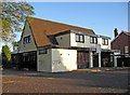
The property market in B63 3DX is dominated by owner-occupied homes, with 76% of residents living in their own properties. This high rate of home ownership indicates a community that values long-term investment and stability, rather than a rental market. The predominance of houses over flats or apartments suggests a focus on family-friendly housing, with larger properties likely to be the norm. Given the small size of the area, the housing stock is limited, meaning buyers may need to consider nearby postcodes for more options. The lack of specific data on property prices or recent sales trends means the market’s dynamics remain opaque, but the high home ownership rate implies a strong sense of local attachment. For buyers, this could mean a competitive environment for available homes, with limited turnover and a need to act swiftly when opportunities arise.
House Prices in B63 3DX
No properties found in this postcode.
Energy Efficiency in B63 3DX
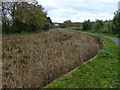
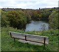
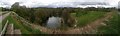
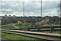
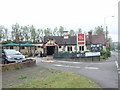
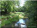
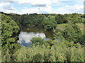
Daily life in B63 3DX is shaped by its proximity to practical amenities. Local shops such as Aldi Halesowen, Iceland Halesowen, and Heron Halesowen provide essential retail and grocery needs, reducing the need for long trips. The rail network, with stations like Old Hill and Rowley Regis, offers easy access to nearby towns and employment hubs, while metro stops at Kenrick Park and West Bromwich Central connect to larger urban areas. For leisure, the area’s historical ties to Halesowen include nearby parks such as The Leasowes, though specific recreational facilities within B63 3DX are not detailed. The combination of retail, transport, and historical context creates a lifestyle that balances convenience with a sense of place. Residents can enjoy the simplicity of suburban living, supported by reliable infrastructure and community-focused amenities.
Amenities
Schools
Residents of B63 3DX have access to several primary schools, including Tenterfields Primary School, Manor Way Primary School, and The Mount School, which specialises in supporting students with specific needs. Two of these schools, Manor Way Primary Academy and Tenterfields Primary Academy, have received a ‘good’ Ofsted rating, indicating a reliable standard of education. The presence of multiple primary schools within close proximity is a significant advantage for families, offering choice and convenience. The inclusion of a special school highlights the area’s commitment to inclusive education, ensuring that children with additional needs are well served. While no secondary schools are listed, the proximity to Halesowen’s broader network likely provides access to further educational options. This mix of school types supports a range of family requirements, from mainstream education to specialist support.
| Rank | School | Type | Entry gender | Ages |
|---|
Explore more schools in this area
Go to Schools tabDemographics
The community in B63 3DX is predominantly composed of adults aged 30–64, with a median age of 47. Home ownership is high, at 76%, reflecting a stable demographic where most residents live in their own homes rather than renting. The area is characterised by a predominance of houses, which suggests a mix of family homes and long-term occupancy. The predominant ethnic group is White, with no specific data provided on other groups. This demographic profile indicates a mature, settled population with established roots. The absence of detailed diversity statistics means the community’s social composition remains largely unquantified, but the high home ownership rate and age range suggest a focus on long-term residency rather than transient populations. For quality of life, this stability may translate to lower turnover and a cohesive local environment, though it also limits the diversity of experiences and perspectives within the area.
Household Size
Accommodation Type
Tenure
Ethnic Group
Religion
Household Composition
Age
Household Deprivation
NS-SEC
Explore more demographic insights in this area
Go to Demographics tabPlanning
Planning Constraints
- Flood RiskPremium
- Ramsar Wetland SitesPremium
- Area of Outstanding Natural BeautyPremium
- Protected Nature ReservePremium
- Protected WoodlandPremium