Area Overview for B63 3DT
Photos of B63 3DT
Area Information
B63 3DT is a small, residential postcode area nestled within the broader Halesowen region of the West Midlands. With a population of 1,469, it reflects a tight-knit community characterised by stability and suburban integration. The area’s historical roots are deep, tracing back to medieval times when Halesowen was noted in the Domesday Book as a significant settlement. Today, it sits within the Dudley Metropolitan Borough, blending historical charm with modern infrastructure. The postcode cluster is part of Halesowen South Ward, a locale defined by its proximity to key transport routes and local amenities. Daily life here is shaped by a mix of practicality and heritage, with residents benefiting from nearby retail, rail, and metro connections. The area’s compact size means it is well-served by essential services, while its integration into the Black Country urban network ensures accessibility to larger towns and cities. For those seeking a balance between tranquillity and connectivity, B63 3DT offers a snapshot of a community that values both historical continuity and contemporary convenience.
- Area Type
- Postcode
- Area Size
- Not available
- Population
- 1469
- Population Density
- 5395 people/km²
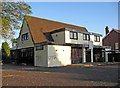
The property market in B63 3DT is dominated by owner-occupied homes, with 79% of properties in private ownership. This high rate of home ownership suggests a stable, long-term resident base rather than a transient rental market. The accommodation type is primarily houses, which is typical of suburban areas with lower population density. This focus on single-family homes indicates a market geared towards families or individuals seeking larger living spaces. Given the area’s small size, the housing stock is likely limited, meaning buyers may need to consider nearby postcode areas for more options. The predominance of houses also implies that properties here are generally larger than in urban centres, which could appeal to those prioritising space and privacy. However, the limited data on property prices or development trends means the market’s dynamics remain somewhat opaque. Buyers should also consider the area’s connectivity to major transport routes, which may influence property desirability and long-term value.
House Prices in B63 3DT
No properties found in this postcode.
Energy Efficiency in B63 3DT
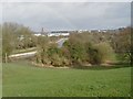
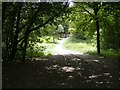
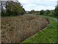
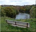
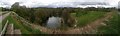
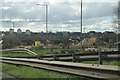
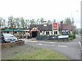
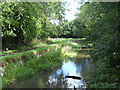
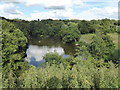
Living in B63 3DT offers access to a range of local amenities that cater to everyday needs. Retail options include Iceland, Heron, and Aldi in Halesowen, providing practical shopping choices. The area’s proximity to rail and metro stations ensures easy access to larger urban centres, while the nearby Leasowes park offers recreational space with 18th-century landscape features. Historical sites such as Halesowen Abbey ruins and the Parish Church of St John the Baptist add cultural depth to daily life. The combination of practical retail, transport links, and green spaces creates a balanced lifestyle, blending convenience with heritage. Residents can enjoy both modern facilities and the tranquillity of nearby natural spaces, making the area appealing for those who value accessibility without sacrificing a connection to the past. The presence of multiple transport options also facilitates social and professional engagement beyond the immediate postcode.
Amenities
Schools
| Rank | School | Type | Entry gender | Ages |
|---|
Explore more schools in this area
Go to Schools tabDemographics
The population of B63 3DT is predominantly adults aged 30–64, with a median age of 47, indicating a mature, settled demographic. Home ownership is high, with 79% of residents living in owner-occupied properties, a figure that suggests long-term residency and financial stability. The accommodation type is primarily houses, reflecting a preference for single-family dwellings over flats or apartments. The predominant ethnic group is White, aligning with broader trends in the West Midlands. While specific data on deprivation is not provided, the high home ownership rate and low crime score (79/100) imply a relatively affluent and secure environment. The area’s demographic profile suggests a community focused on family living, with limited presence of younger or older age groups. This profile may influence local services and amenities, which are tailored to the needs of middle-aged and older residents. The absence of detailed diversity metrics means the area’s social composition remains largely defined by its dominant ethnic group.
Household Size
Accommodation Type
Tenure
Ethnic Group
Religion
Household Composition
Age
Household Deprivation
NS-SEC
Explore more demographic insights in this area
Go to Demographics tabPlanning
Planning Constraints
- Flood RiskPremium
- Ramsar Wetland SitesPremium
- Area of Outstanding Natural BeautyPremium
- Protected Nature ReservePremium
- Protected WoodlandPremium