Area Overview for B63 3AD
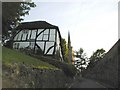
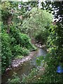
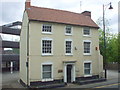
Photos of B63 3AD
Area Information
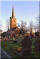
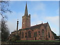
Living in B63 3AD means being part of a tightly knit residential cluster in the heart of Halesowen, a historically significant area in the West Midlands. The postcode covers 364 square metres and is home to 1,849 residents, creating a dense, community-focused environment. Halesowen itself has roots dating back to the Domesday Book, with its name reflecting its medieval origins as a remote valley. Today, the area is integrated into the broader Black Country urban landscape, blending historical character with modern infrastructure. Residents benefit from proximity to essential services, including a primary school with a good Ofsted rating and multiple transport links. The area’s compact nature ensures that amenities are within practical reach, though its small size means it is best suited for those prioritising convenience over expansive living spaces. With a population density of over 5 million per square kilometre, B63 3AD is a highly concentrated residential zone, ideal for those seeking a compact, accessible lifestyle in a historically rich setting.
- Area Type
- Postcode
- Area Size
- 364 m²
- Population
- 1849
- Population Density
- 6637 people/km²
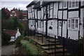
The property market in B63 3AD is characterised by a high proportion of rental properties, with only 19% of residents owning their homes. The accommodation type is predominantly flats, which aligns with the area’s small size and high population density. This suggests a market geared more towards tenants than buyers, with limited opportunities for owner-occupation. For those considering purchasing, the availability of flats may be more practical than detached or semi-detached homes, which are likely scarce in such a compact postcode. The small size of B63 3AD also means that the immediate surrounding areas are critical for housing options, requiring buyers to look beyond the postcode for larger properties. The rental market here is likely competitive, with demand driven by the area’s proximity to transport links and amenities.
House Prices in B63 3AD
No properties found in this postcode.
Energy Efficiency in B63 3AD
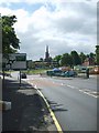
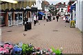
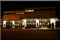
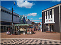
The lifestyle in B63 3AD is shaped by its proximity to a variety of amenities within practical reach. Residents have access to five retail outlets, including Iceland Halesowen and Lidl Halesowen, offering everyday shopping needs. The area’s transport links also provide access to nearby leisure and dining options, though specific venues are not detailed in the data. The presence of multiple railway and metro stations ensures easy access to broader urban centres, supporting a dynamic lifestyle. While the data does not list parks or recreational spaces directly, the historical context of Halesowen suggests nearby green spaces, such as the Leasowes, which may be accessible to residents. This blend of retail, transport, and potential outdoor spaces contributes to a balanced, convenient living environment.
Amenities
Schools
The nearest school to B63 3AD is Our Lady and St Kenelm RC School, a primary school with a good Ofsted rating. This institution serves the local community, providing education for younger children within walking distance of many homes. The presence of a primary school with a positive rating is a significant draw for families, ensuring access to quality early education. However, the data does not include secondary schools or other educational institutions, meaning parents may need to look further afield for comprehensive schooling. The single listed school highlights the importance of its role in the area, though it does not indicate a broader range of educational options.
| Rank | School | Type | Entry gender | Ages |
|---|
Explore more schools in this area
Go to Schools tabDemographics
The community in B63 3AD is predominantly composed of adults aged 30–64, with a median age of 47. Only 19% of residents own their homes, indicating a rental-heavy market, while the majority live in flats, reflecting the area’s compact residential layout. The predominant ethnic group is White, though specific data on diversity beyond this is not provided. The population density of 5,075,075 people per square kilometre underscores the area’s high concentration of residents, which can influence the pace of daily life and the availability of shared resources. For families, the presence of a primary school with a good Ofsted rating offers a key anchor for local living. However, the low home ownership rate suggests a transient population, which may affect the sense of long-term community stability.
Household Size
Accommodation Type
Tenure
Ethnic Group
Religion
Household Composition
Age
Household Deprivation
NS-SEC
Explore more demographic insights in this area
Go to Demographics tabPlanning
Planning Constraints
- Flood RiskPremium
- Ramsar Wetland SitesPremium
- Area of Outstanding Natural BeautyPremium
- Protected Nature ReservePremium
- Protected WoodlandPremium