Area Overview for B63 2TA
Photos of B63 2TA
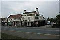
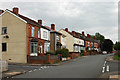
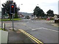
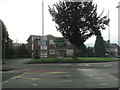
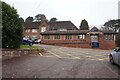
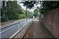
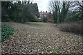
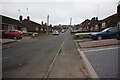
41 photos from this area
Area Information
Key information about the B63 2TA including its size, population, and administrative classification.
- Area Type
- Postcode
- Area Size
- 4715 m²
- Population
- 1640
- Population Density
- 6392 people/km²
House Prices in B63 2TA
14
Properties
£121,200
Average Sold Price
£41,000
Lowest Price
£173,000
Highest Price
Showing 14 properties
| Address | Type | Beds | Baths | Last Sale Price | Last Sale Date | |
|---|---|---|---|---|---|---|
| 54 Furlong Lane, Cradley, B63 2TA | Semi-detached | 2 | 2 | £173,000 | Feb 2019 | |
| 97 Furlong Lane, Cradley, B63 2TA | Semi-detached | 3 | 1 | £145,000 | Sep 2018 | |
| 89 Furlong Lane, Cradley, B63 2TA | house | - | - | £126,500 | Aug 2016 | |
| 87 Furlong Lane, Cradley, B63 2TA | Semi-detached | 2 | 1 | £70,000 | May 2014 | |
| 64A Furlong Lane, Cradley, B63 2TA | house | - | - | £148,500 | Oct 2010 | |
| 52 Furlong Lane, Cradley, B63 2TA | Semi-detached | 3 | 1 | £128,000 | Oct 2008 | |
| 62 Furlong Lane, Cradley, B63 2TA | house | - | - | £168,000 | Oct 2006 | |
| 56 Furlong Lane, Cradley, B63 2TA | Terraced | - | - | £137,000 | Feb 2004 | |
| 91 Furlong Lane, Cradley, B63 2TA | Terraced | - | - | £41,000 | Nov 1996 | |
| 64 Furlong Lane, Cradley, B63 2TA | Detached | - | - | £75,000 | Nov 1995 |
Page 1 of 2
Energy Efficiency in B63 2TA
Amenities
Schools
| Rank | School | Type | Entry gender | Ages |
|---|
Explore more schools in this area
Go to Schools tabDemographics
Household Size
Two person
most common
Accommodation Type
Houses
most common
Tenure
66
majority
Ethnic Group
White
most common
Religion
N/A
most common
Household Composition
N/A
most common
Age
47
median
Adults (30-64 years)
most common
Household Deprivation
N/A
with no deprivation
NS-SEC
28
in Lower managerial occupations
Explore more demographic insights in this area
Go to Demographics tabPlanning
Planning Constraints
- Flood RiskPremium
- Ramsar Wetland SitesPremium
- Area of Outstanding Natural BeautyPremium
- Protected Nature ReservePremium
- Protected WoodlandPremium