Area Overview for B63 2SF
Photos of B63 2SF
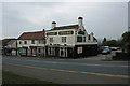
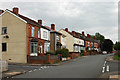
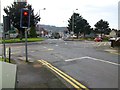
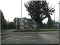
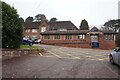
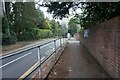
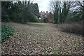
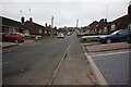
41 photos from this area
Area Information
Key information about the B63 2SF including its size, population, and administrative classification.
- Area Type
- Postcode
- Area Size
- 1.1 hectares
- Population
- 1951
- Population Density
- 5253 people/km²
House Prices in B63 2SF
31
Properties
£107,934
Average Sold Price
£35,000
Lowest Price
£200,000
Highest Price
Showing 31 properties
| Address | Type | Beds | Baths | Last Sale Price | Last Sale Date | |
|---|---|---|---|---|---|---|
| 50 Banners Street, Cradley, B63 2SF | Semi-detached | 3 | 1 | £150,000 | Sep 2023 | |
| 30 Banners Street, Cradley, B63 2SF | Terraced | 3 | 1 | £172,000 | Jul 2022 | |
| 54 Banners Street, Cradley, B63 2SF | Semi-detached | 3 | 2 | £200,000 | Oct 2019 | |
| 32 Banners Street, Cradley, B63 2SF | Terraced | 2 | 1 | £135,000 | Oct 2018 | |
| 38A Banners Street, Cradley, B63 2SF | Semi-detached | 2 | 1 | £108,000 | Aug 2016 | |
| 46 Banners Street, Cradley, B63 2SF | house | - | - | £65,000 | May 2016 | |
| 48 Banners Street, Cradley, B63 2SF | house | - | - | £115,000 | Dec 2009 | |
| 38 Banners Street, Cradley, B63 2SF | house | 2 | - | £81,000 | Apr 2008 | |
| 52 Banners Street, Cradley, B63 2SF | Detached | - | - | £134,000 | Feb 2008 | |
| 16A Banners Street, Cradley, B63 2SF | Terraced | 2 | 1 | £79,000 | Sep 2007 |
Page 1 of 4
Energy Efficiency in B63 2SF
Amenities
Schools
| Rank | School | Type | Entry gender | Ages |
|---|
Explore more schools in this area
Go to Schools tabDemographics
Household Size
Family (3-5 people)
most common
Accommodation Type
Houses
most common
Tenure
68
majority
Ethnic Group
White
most common
Religion
N/A
most common
Household Composition
N/A
most common
Age
47
median
Adults (30-64 years)
most common
Household Deprivation
N/A
with no deprivation
NS-SEC
33
in Lower managerial occupations
Explore more demographic insights in this area
Go to Demographics tabPlanning
Planning Constraints
- Flood RiskPremium
- Ramsar Wetland SitesPremium
- Area of Outstanding Natural BeautyPremium
- Protected Nature ReservePremium
- Protected WoodlandPremium