Area Overview for B63 2QF
Photos of B63 2QF
Area Information
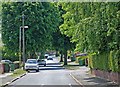
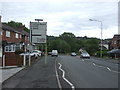
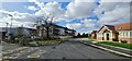
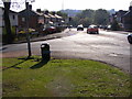
Living in B63 2QF means being part of a small, tightly knit residential cluster in the Dudley metropolitan borough, West Midlands. The area, home to around 1,531 people, sits within the broader Cradley North & Wollescote district, historically part of the Black Country. It is bordered by Halesowen to the east and lies approximately three miles east of Stourbridge town centre. Daily life here blends suburban comfort with historical roots, from the 1920s development of Wollescote into post-war housing estates to Cradley’s integration with Halesowen. The area’s character is defined by low-rise homes, former tower blocks, and redeveloped parkland. While it lacks the density of larger towns, it offers a quieter, community-focused environment. Residents benefit from proximity to Stourbridge’s amenities and the surrounding countryside, though the area remains distinct in its mix of private and council housing. For those seeking a balance between residential tranquillity and access to nearby towns, B63 2QF provides a compact, self-contained living experience.
- Area Type
- Postcode
- Area Size
- Not available
- Population
- 1531
- Population Density
- 4055 people/km²
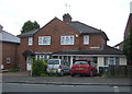
The property market in B63 2QF is characterised by a high rate of home ownership (79%) and a predominance of houses over flats or apartments. This suggests a residential area focused on family homes and long-term occupancy rather than rental properties. The presence of both private and council housing indicates a mix of tenure types, though the majority of properties are owner-occupied. Given the area’s small size and suburban nature, the housing stock is likely to include a range of styles, from traditional low-rise homes to post-war estates. For buyers, this means a market that prioritises stability and permanence, with limited turnover. The proximity to Stourbridge and Halesowen may also influence property values, as residents can access larger towns for employment or leisure without leaving the immediate area. However, the small size of B63 2QF means the local market is unlikely to offer extensive variety, requiring buyers to consider nearby postcode areas for broader options.
House Prices in B63 2QF
No properties found in this postcode.
Energy Efficiency in B63 2QF
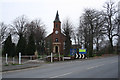
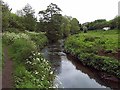
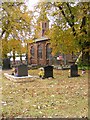
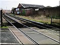
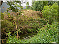
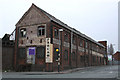
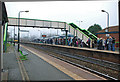
Residents of B63 2QF have access to a range of local amenities within practical reach. Retail options include Aldi Dudley, Lidl Cradley, and Lidl Merry, offering everyday shopping needs. The area’s rail network, with stations like Cradley Heath and Lye, provides easy access to larger towns, while metro stops such as Dartmouth Street and Lodge Road connect to Dudley’s urban centres. For leisure, the nearby Wollescote Park and historical sites like Wollescote Hall offer green spaces and cultural heritage. The area’s suburban layout means a mix of local parks and open spaces, though larger recreational facilities may require travel to Stourbridge or Halesowen. The presence of community groups and historical landmarks adds a layer of local identity, making daily life in B63 2QF both practical and rooted in the region’s history.
Amenities
Schools
| Rank | School | Type | Entry gender | Ages |
|---|
Explore more schools in this area
Go to Schools tabDemographics
The population of B63 2QF is predominantly middle-aged, with a median age of 47 and the most common age range being adults aged 30–64. This suggests a stable community with a strong presence of families and working-age residents. Home ownership is high, at 79%, indicating a significant proportion of residents live in properties they own, which can contribute to a sense of long-term investment in the area. The accommodation type is primarily houses, reflecting a suburban rather than high-density housing profile. The predominant ethnic group is White, aligning with broader trends in the West Midlands. While no specific data on deprivation is provided, the high home ownership rate and low crime risk (79/100) suggest a relatively stable socioeconomic environment. The absence of significant diversity metrics means the area’s demographic makeup remains largely homogeneous, which may influence community dynamics and local services.
Household Size
Accommodation Type
Tenure
Ethnic Group
Religion
Household Composition
Age
Household Deprivation
NS-SEC
Explore more demographic insights in this area
Go to Demographics tabPlanning
Planning Constraints
- Flood RiskPremium
- Ramsar Wetland SitesPremium
- Area of Outstanding Natural BeautyPremium
- Protected Nature ReservePremium
- Protected WoodlandPremium