Area Overview for B63 2LH
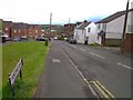
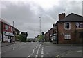
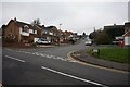
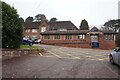
Photos of B63 2LH

Area Information
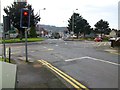
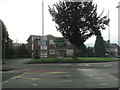
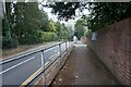
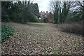
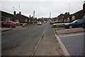
B63 2LH is a small, residential postcode area nestled in the suburban outskirts of Halesowen, West Midlands. With a population of just 1,585, it reflects a quiet, established community characterised by older housing stock built between the 1930s and 1970s. The area forms part of the Hayley Green and Cradley South ward, a district known for its owner-occupied homes and proximity to green belt land. Residents enjoy a suburban lifestyle at the edge of the Black Country, with farmland and open countryside surrounding three sides. The area’s history is rooted in the ancient township of Lutley, once an independent village before merging with Halesowen. Notable local landmarks include Uffmoor Wood, a 300-acre ancient woodland, and the Fox Hunt public house, a focal point for community activity. B63 2LH is accessible via key transport routes like the A456, linking it to Birmingham and Kidderminster, while nearby railway stations offer connections to larger urban centres. This blend of historical character, natural surroundings, and practical connectivity makes it a distinct choice for those seeking a balanced lifestyle.
- Area Type
- Postcode
- Area Size
- Not available
- Population
- 1585
- Population Density
- 3836 people/km²
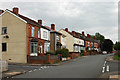
B63 2LH is primarily an owner-occupied area, with 62% of properties owned by residents rather than rented. The housing stock consists largely of houses, many of which date back to the 1930s–1970s. These properties are concentrated in estates such as Causey Farm and St Kenelms Avenue, reflecting a mix of mid-century architectural styles. The predominance of owner-occupied homes suggests a community of long-term residents, which can influence property values and market dynamics. For buyers, this means a focus on established, well-maintained homes rather than newer developments. The area’s proximity to green belt land and farmland may also affect property desirability, offering a quieter alternative to denser urban areas. However, the small size of the postcode area means that the immediate surroundings, including nearby wards, may offer more diverse housing options. Potential buyers should consider the age of properties when assessing maintenance needs and the potential for future value appreciation.
House Prices in B63 2LH
No properties found in this postcode.
Energy Efficiency in B63 2LH
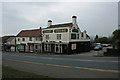
Living in B63 2LH offers a mix of suburban convenience and access to natural spaces. Nearby amenities include retail outlets such as Lidl Cradley, Tesco Stourbridge, and Tesco Lye, providing everyday shopping needs. The area is also close to the Fox Hunt public house, a local hub for socialising, and the A456/B4183 roundabout, which hosts small shops. Recreational opportunities are abundant, with Uffmoor Wood offering walks through ancient woodland, and the Clent Hills providing open countryside for outdoor activities. The Hagley Golf and Country Club caters to those interested in leisure sports. The suburban character of B63 2LH, bordered by farmland, allows residents to enjoy a quieter lifestyle while remaining within reach of urban amenities. The presence of both local shops and green spaces ensures a balanced approach to daily life, combining practicality with access to nature.
Amenities
Schools
| Rank | School | Type | Entry gender | Ages |
|---|
Explore more schools in this area
Go to Schools tabDemographics
The population of B63 2LH is predominantly adults aged 30–64, with a median age of 47. This suggests a mature, stable community with a focus on established households. Home ownership is high, at 62%, reflecting a strong presence of long-term residents. The accommodation types are primarily houses, aligning with the area’s older housing estates. The predominant ethnic group is White, which is consistent with broader trends in the region. While specific data on deprivation is not provided, the high home ownership rate and the presence of mid-20th-century housing suggest a relatively stable economic profile. The area’s demographic makeup indicates a community that values continuity and local ties, with fewer transient populations. This stability is reinforced by the absence of significant planning constraints or environmental risks, which are common in more rapidly developing areas. The age profile also implies a demand for family-friendly amenities and services tailored to middle-aged residents.
Household Size
Accommodation Type
Tenure
Ethnic Group
Religion
Household Composition
Age
Household Deprivation
NS-SEC
Explore more demographic insights in this area
Go to Demographics tabPlanning
Planning Constraints
- Flood RiskPremium
- Ramsar Wetland SitesPremium
- Area of Outstanding Natural BeautyPremium
- Protected Nature ReservePremium
- Protected WoodlandPremium