Area Overview for B63 1LF
Photos of B63 1LF
Area Information
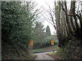
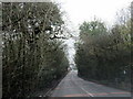
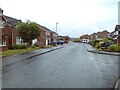
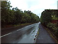
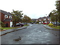
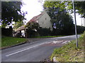
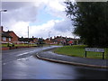
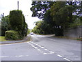
Living in B63 1LF means inhabiting a small, defined postcode area within Hayley Green, a suburb of Halesowen in the West Midlands. This area sits at the edge of the Black Country conurbation, bordered by farmland and green belt land, offering a suburban feel with a quiet, semi-rural backdrop. The population of 1,511 reflects a tight-knit community, with housing stock predominantly built between the 1930s and 1970s. These include estates like Causey Farm and St Kenelms Avenue, which give the area a distinct character of mid-20th-century domestic architecture. Historically, Hayley Green was a village within the ancient township of Lutley, later absorbed into Halesowen. Today, it retains a reputation for being relatively affluent, with owner-occupied homes forming the backbone of its housing market. The area’s proximity to the West Midlands/Worcestershire border means it straddles two regions, offering access to both urban and rural amenities. Daily life here balances the convenience of nearby retail and transport links with the tranquillity of surrounding countryside, making it a practical choice for those seeking a settled, low-maintenance lifestyle.
- Area Type
- Postcode
- Area Size
- Not available
- Population
- 1511
- Population Density
- 2698 people/km²
The property market in B63 1LF is dominated by owner-occupied homes, with 90% of properties in private hands. This high rate of home ownership indicates a stable, long-term resident base, often linked to the area’s mid-20th-century housing stock. The predominant accommodation type is houses, many of which are part of older estates such as Causey Farm and Squirrels, built between the 1930s and 1970s. These homes offer a mix of semi-detached and terraced styles, reflecting the era of their construction. For buyers, this means a market focused on established properties rather than new builds, with potential for value retention in a low-risk environment. The small size of the postcode area means that properties are closely grouped, and the immediate surroundings offer similar housing types. Buyers should consider the age of homes when evaluating maintenance needs, though the high ownership rate suggests a lack of rental pressure and a steady demand for residential properties in this niche market.
House Prices in B63 1LF
No properties found in this postcode.
Energy Efficiency in B63 1LF
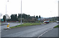
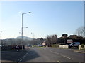
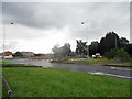
Residents of B63 1LF have access to a range of local amenities within practical reach. Retail options include Spar, Co-op Halesowen, and Tesco Hasbury, providing essential shopping and convenience stores. The area is served by five railway stations, including Lye and Cradley Heath, offering direct links to Birmingham and surrounding towns. For leisure, the Fox Hunt public house (a Harvester chain outlet) and a cluster of small shops at the A456/B4183 roundabout add to the local character. Nearby, Uffmoor Wood—a 300-acre ancient woodland—offers walking and outdoor activities, while the Clent Hills provide scenic views. The Hagley Golf and Country Club caters to those seeking recreational sports. This mix of retail, transport, and natural spaces creates a lifestyle that balances convenience with access to green spaces, making daily life in B63 1LF both practical and pleasant.
Amenities
Schools
| Rank | School | Type | Entry gender | Ages |
|---|
Explore more schools in this area
Go to Schools tabDemographics
The population of B63 1LF is 1,511, with a median age of 47, indicating a mature demographic skewed toward adults aged 30–64. This age group dominates, reflecting a community with established careers and long-term residential patterns. Home ownership is exceptionally high at 90%, suggesting stability and a preference for long-term investment in property. The predominant accommodation type is houses, aligning with the area’s character of older, semi-detached or terraced homes. The predominant ethnic group is White, though specific diversity metrics are not detailed in the data. The absence of significant deprivation indicators implies a generally stable quality of life, with residents likely enjoying secure employment and access to essential services. This demographic profile suggests a community focused on comfort and continuity, with fewer transient populations compared to other urban areas.
Household Size
Accommodation Type
Tenure
Ethnic Group
Religion
Household Composition
Age
Household Deprivation
NS-SEC
Explore more demographic insights in this area
Go to Demographics tabPlanning
Planning Constraints
- Flood RiskPremium
- Ramsar Wetland SitesPremium
- Area of Outstanding Natural BeautyPremium
- Protected Nature ReservePremium
- Protected WoodlandPremium