Area Overview for B63 1DB
Photos of B63 1DB
Area Information
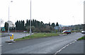
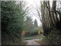
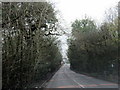
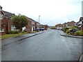
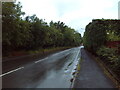
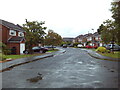
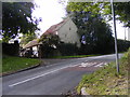
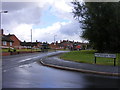
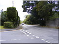
Living in B63 1DB means residing in a compact, residential cluster within Hayley Green, a suburb of Halesowen in the West Midlands. This area, with a population of 1,360 and a density of 1,196 people per square kilometre, sits at the edge of the Black Country conurbation, bordered by farmland and green belt land. Its character is defined by mid-20th-century housing estates, such as Causey Farm and St Kenelms Avenue, many built between the 1930s and 1970s. The area’s suburban feel is tempered by proximity to natural spaces like Uffmoor Wood and the Clent Hills. Historically, Hayley Green was a self-contained village before merging with Halesowen. Notable residents include Robert Plant, who lived here as a teenager. The area’s mix of older homes and strategic transport links to Birmingham and Kidderminster makes it a practical choice for those seeking a quieter lifestyle with access to urban amenities.
- Area Type
- Postcode
- Area Size
- Not available
- Population
- 1360
- Population Density
- 1196 people/km²
B63 1DB is a predominantly owner-occupied area, with 94% of homes owned by residents rather than rented. The housing stock consists almost entirely of houses, reflecting a lack of high-density development. This aligns with the area’s character as a cluster of mid-20th-century estates, many built between the 1930s and 1970s. The absence of flats or apartments suggests a focus on family homes, though the small size of the postcode means the immediate surroundings may share similar property types. For buyers, this implies a stable market with established properties, though the age of the housing stock may require attention to maintenance or renovation. The high home ownership rate also indicates a community of long-term residents, which can be a factor in property value stability.
House Prices in B63 1DB
No properties found in this postcode.
Energy Efficiency in B63 1DB
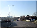
Residents of B63 1DB have access to a range of amenities within practical reach. Retail options include Co-op Halesowen, Tesco Hasbury, and Spar, while the A456 roundabout hosts a cluster of small shops and the Fox Hunt public house (Harvester chain). The area’s proximity to Uffmoor Wood, Clent Hills, and Hagley Golf and Country Club offers recreational opportunities in natural and green spaces. Transport links to rail stations and bus routes enhance mobility, and the suburban setting provides a balance between urban convenience and countryside tranquillity. The presence of a 300-acre ancient woodland and nearby golf course adds to the area’s appeal for those seeking both leisure and outdoor activities.
Amenities
Schools
| Rank | School | Type | Entry gender | Ages |
|---|
Explore more schools in this area
Go to Schools tabDemographics
The community in B63 1DB is predominantly middle-aged, with a median age of 47 and the majority of residents falling within the 30–64 age range. Home ownership is exceptionally high at 94%, with most properties being houses rather than flats. The predominant ethnic group is White, reflecting a largely homogenous population. The area’s compact size and high population density suggest a tightly knit community, though data on diversity or deprivation is not provided. The age profile indicates a stable, established demographic, with fewer young families or elderly residents compared to other areas. This profile may influence local services and amenities, which cater to the needs of working-age adults and older homeowners.
Household Size
Accommodation Type
Tenure
Ethnic Group
Religion
Household Composition
Age
Household Deprivation
NS-SEC
Explore more demographic insights in this area
Go to Demographics tabPlanning
Planning Constraints
- Flood RiskPremium
- Ramsar Wetland SitesPremium
- Area of Outstanding Natural BeautyPremium
- Protected Nature ReservePremium
- Protected WoodlandPremium
- Crime RiskPremium