Area Overview for B62 9EY
Photos of B62 9EY
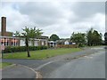
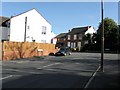
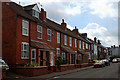
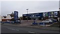
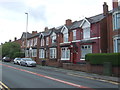
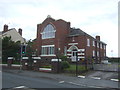
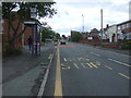
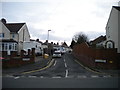
14 photos from this area
Area Information
Key information about the B62 9EY including its size, population, and administrative classification.
- Area Type
- Postcode
- Area Size
- 8846 m²
- Population
- 2402
- Population Density
- 4281 people/km²
House Prices in B62 9EY
39
Properties
£116,441
Average Sold Price
£33,000
Lowest Price
£255,000
Highest Price
Showing 39 properties
| Address | Type | Beds | Baths | Last Sale Price | Last Sale Date | |
|---|---|---|---|---|---|---|
| 28 Belgrave Road, Halesowen, B62 9EY | Semi-detached | 3 | 1 | £255,000 | Jul 2025 | |
| 16 Belgrave Road, Halesowen, B62 9EY | Terraced | 3 | 1 | £207,500 | Jan 2022 | |
| 17 Belgrave Road, Halesowen, B62 9EY | Terraced | 2 | 1 | £145,000 | Jul 2021 | |
| 37 Belgrave Road, Halesowen, B62 9EY | Terraced | 2 | 1 | £139,500 | Jul 2020 | |
| 27 Belgrave Road, Halesowen, B62 9EY | Terraced | 2 | 1 | £137,000 | Dec 2019 | |
| 33 Belgrave Road, Halesowen, B62 9EY | house | - | - | £80,000 | Oct 2019 | |
| 39 Belgrave Road, Halesowen, B62 9EY | Terraced | 2 | 1 | £155,000 | Mar 2019 | |
| 19 Belgrave Road, Halesowen, B62 9EY | house | - | - | £119,000 | Apr 2018 | |
| 42 Belgrave Road, Halesowen, B62 9EY | Terraced | 3 | 1 | £115,000 | Feb 2016 | |
| 41 Belgrave Road, Halesowen, B62 9EY | Terraced | 3 | 1 | £110,000 | Jul 2015 |
Page 1 of 4
Energy Efficiency in B62 9EY
Amenities
Schools
| Rank | School | Type | Entry gender | Ages |
|---|
Explore more schools in this area
Go to Schools tabDemographics
Household Size
Two person
most common
Accommodation Type
Houses
most common
Tenure
71
majority
Ethnic Group
White
most common
Religion
N/A
most common
Household Composition
N/A
most common
Age
47
median
Adults (30-64 years)
most common
Household Deprivation
N/A
with no deprivation
NS-SEC
34
in Lower managerial occupations
Explore more demographic insights in this area
Go to Demographics tabPlanning
Planning Constraints
- Flood RiskPremium
- Ramsar Wetland SitesPremium
- Area of Outstanding Natural BeautyPremium
- Protected Nature ReservePremium
- Protected WoodlandPremium