Area Overview for B62 9AW
Photos of B62 9AW
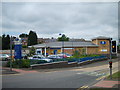
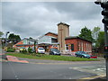
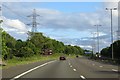
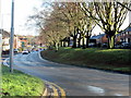

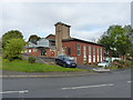

19 photos from this area
Area Information
Key information about the B62 9AW including its size, population, and administrative classification.
- Area Type
- Postcode
- Area Size
- 3.5 hectares
- Population
- 1517
- Population Density
- 3983 people/km²
House Prices in B62 9AW
57
Properties
£198,159
Average Sold Price
£58,750
Lowest Price
£325,000
Highest Price
Showing 57 properties
| Address | Type | Beds | Baths | Last Sale Price | Last Sale Date | |
|---|---|---|---|---|---|---|
| 52 Woodbury Road, Halesowen, B62 9AW | Detached | 3 | 1 | £325,000 | Sep 2025 | |
| 85 Woodbury Road, Halesowen, B62 9AW | Semi-detached | 3 | 1 | £323,000 | Jan 2025 | |
| 99 Woodbury Road, Halesowen, B62 9AW | Semi-detached | 3 | 2 | £249,000 | Dec 2023 | |
| 123 Woodbury Road, Halesowen, B62 9AW | Bungalow | 2 | - | £187,000 | Oct 2023 | |
| 67 Woodbury Road, Halesowen, B62 9AW | Semi-detached | 4 | - | £235,000 | Aug 2023 | |
| 119 Woodbury Road, Halesowen, B62 9AW | Retail | 2 | 1 | £275,000 | Dec 2022 | |
| 75 Woodbury Road, Halesowen, B62 9AW | Retail | 3 | 1 | £200,000 | Nov 2022 | |
| 81 Woodbury Road, Halesowen, B62 9AW | house | - | - | £297,000 | Aug 2022 | |
| 32 Woodbury Road, Halesowen, B62 9AW | house | - | - | £239,000 | Mar 2021 | |
| 64 Woodbury Road, Halesowen, B62 9AW | Semi-detached | 4 | 2 | £325,000 | Nov 2020 |
Page 1 of 6
Energy Efficiency in B62 9AW
Amenities
Schools
| Rank | School | Type | Entry gender | Ages |
|---|
Explore more schools in this area
Go to Schools tabDemographics
Household Size
Two person
most common
Accommodation Type
Houses
most common
Tenure
89
majority
Ethnic Group
White
most common
Religion
N/A
most common
Household Composition
N/A
most common
Age
47
median
Adults (30-64 years)
most common
Household Deprivation
N/A
with no deprivation
NS-SEC
36
in Lower managerial occupations
Explore more demographic insights in this area
Go to Demographics tabPlanning
Planning Constraints
- Flood RiskPremium
- Ramsar Wetland SitesPremium
- Area of Outstanding Natural BeautyPremium
- Protected Nature ReservePremium
- Protected WoodlandPremium