Area Overview for B62 8SF
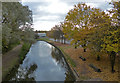
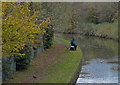
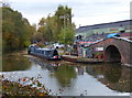
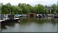
Photos of B62 8SF


Area Information
Living in B62 8SF means being part of a small, densely populated residential cluster in the heart of Halesowen, a historic market town in Dudley, West Midlands. With a population of 1,580 and a density of 1,194 people per square kilometre, this area reflects the compact, community-oriented character of Halesowen itself. The town, recorded in the Domesday Book as larger than modern Birmingham, has a legacy of industrial and medieval history, including the remnants of Halesowen Abbey and its once-thriving nail-making industry. Today, the area is defined by its proximity to local amenities, transport links, and a mix of residential housing. The median age of 47 suggests a mature, stable population, with adults aged 30–64 forming the majority. This makes B62 8SF a place where established families and long-term residents coexist, shaped by the town’s historical roots and its role as a hub for nearby cities like Birmingham.
- Area Type
- Postcode
- Area Size
- Not available
- Population
- 1580
- Population Density
- 1194 people/km²
The property market in B62 8SF is characterised by a high rate of home ownership (65%) and a focus on houses rather than flats or apartments. This suggests a market skewed towards owner-occupied properties, likely catering to families and long-term residents. The concentration of houses implies a preference for larger, more private living spaces, which may appeal to those seeking stability in a small, established area. However, the limited data on property types or price ranges means buyers must consider the broader Dudley region for comparative insights. The small size of B62 8SF means that the immediate surroundings are critical for property searches, with nearby areas offering similar housing stock. For buyers, this translates to a market where availability is constrained by the area’s compact nature, but the existing properties reflect a blend of traditional and modern housing styles.
House Prices in B62 8SF
No properties found in this postcode.
Energy Efficiency in B62 8SF
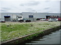
The lifestyle in B62 8SF is shaped by its proximity to retail, transport, and local services. Within practical reach are major retailers such as Makro Birmingham, Tesco Dudley, and Aldi Halesowen, offering a range of shopping options. The area’s rail and metro stations provide easy access to urban centres, while the compact nature of the postcode cluster ensures amenities are within walking or short driving distance. Although specific parks or leisure facilities are not detailed in the data, the town’s historical and industrial heritage suggests a mix of green spaces and community hubs. This blend of convenience and connectivity supports a lifestyle that balances daily needs with the ability to travel further afield for recreation or work.
Amenities
Schools
Residents of B62 8SF have access to a range of educational institutions, from primary schools to sixth-form colleges. Newfield Park Primary School and Halesowen CofE Primary School both offer primary education, with the latter holding a ‘good’ Ofsted rating. The Earls High School serves as both a primary and academy school, also rated ‘good’, while Halesowen College provides sixth-form education. This mix ensures families can access education at multiple stages without long commutes. The presence of both state and academy schools reflects a diverse educational landscape, though no secondary schools are explicitly listed. For parents, this means a reliable network of schools within the area, though further research may be needed for specific admission criteria or catchment areas.
| Rank | School | Type | Entry gender | Ages |
|---|
Explore more schools in this area
Go to Schools tabDemographics
The community in B62 8SF is predominantly middle-aged, with a median age of 47 and the largest age group being adults aged 30–64. Home ownership is strong, with 65% of properties occupied by their owners, reflecting a stable housing market. The accommodation type is primarily houses, which aligns with the area’s residential character. The predominant ethnic group is White, though specific diversity statistics are not provided. This demographic profile suggests a settled, family-oriented community with limited generational turnover. The high home ownership rate indicates long-term residency, while the prevalence of houses over flats or apartments suggests a preference for private, spacious living. The absence of detailed data on deprivation means that quality of life is inferred from the area’s amenities and infrastructure, which appear to support a modest but functional lifestyle.
Household Size
Accommodation Type
Tenure
Ethnic Group
Religion
Household Composition
Age
Household Deprivation
NS-SEC
Explore more demographic insights in this area
Go to Demographics tabPlanning
Planning Constraints
- Flood RiskPremium
- Ramsar Wetland SitesPremium
- Area of Outstanding Natural BeautyPremium
- Protected Nature ReservePremium
- Protected WoodlandPremium