Area Overview for B62 8BH
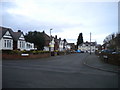
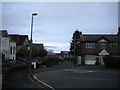
Photos of B62 8BH
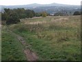
![Remains of Stewarts & Lloyds Coombeswood Works [2] in B62 8BH](https://images.propbar.co.uk/images/geograph/58/08/5808887_120.jpg)
28 photos from this area
Area Information
Key information about the B62 8BH including its size, population, and administrative classification.
- Area Type
- Postcode
- Area Size
- 15.9 hectares
- Population
- 1640
- Population Density
- 2039 people/km²
House Prices in B62 8BH
10
Properties
-
Average Sold Price
-
Lowest Price
-
Highest Price
Showing 10 properties
| Address | Type | Beds | Baths | Last Sale Price | Last Sale Date | |
|---|---|---|---|---|---|---|
| Toolbank Specialist Services, Unit E2, Coombswood Way, Halesowen, B62 8BH | storage_distribution | - | - | - | - | |
| Stannah Lift Systems, Units 1 To 4, Block A6, Coombswood Way, Halesowen, B62 8BH | office_workshop | - | - | - | - | |
| Youth For Christ, Unit D2, Coombswood Way, Halesowen, B62 8BH | community_day_centre | - | - | - | - | |
| Ultimate Communications Systems Ltd, Unit 4, Block A7, Coombswood Way, Halesowen, B62 8BH | Office | - | - | - | - | |
| First Air, Unit 2, Block A7, Coombswood Way, Halesowen, B62 8BH | office_workshop | - | - | - | - | |
| P And R Morson And Co Ltd, Laborem Place, Unit E3, Coombswood Way, Halesowen, B62 8BH | office_workshop | - | - | - | - | |
| Elegance Solutions Ltd, Units 5 To 6, Block A7, Coombswood Way, Halesowen, B62 8BH | Office | - | - | - | - | |
| Creation House Print And Design, Unit 5, Block A6, Coombswood Way, Halesowen, B62 8BH | office_workshop | - | - | - | - | |
| Coombswood East Industrial Site, Coombs Road, Halesowen, B62 8BH | Industrial | - | - | - | - | |
| Warwick Control Technologies, Unit 3, Block A7, Coombswood Way, Halesowen, B62 8BH | Office | - | - | - | - |
Energy Efficiency in B62 8BH
Amenities
Schools
| Rank | School | Type | Entry gender | Ages |
|---|
Explore more schools in this area
Go to Schools tabDemographics
Household Size
Family (3-5 people)
most common
Accommodation Type
Houses
most common
Tenure
79
majority
Ethnic Group
White
most common
Religion
N/A
most common
Household Composition
N/A
most common
Age
47
median
Adults (30-64 years)
most common
Household Deprivation
N/A
with no deprivation
NS-SEC
31
in Lower managerial occupations
Explore more demographic insights in this area
Go to Demographics tabPlanning
Planning Constraints
- Flood RiskPremium
- Ramsar Wetland SitesPremium
- Area of Outstanding Natural BeautyPremium
- Protected Nature ReservePremium
- Protected WoodlandPremium