Area Overview for B62 0NF
Photos of B62 0NF
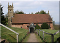
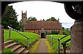
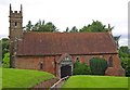
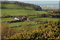
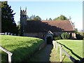
62 photos from this area
Area Information
Key information about the B62 0NF including its size, population, and administrative classification.
- Area Type
- Postcode
- Area Size
- 47.5 hectares
- Population
- 1154
- Population Density
- 66 people/km²
House Prices in B62 0NF
10
Properties
£951,667
Average Sold Price
£530,000
Lowest Price
£1,475,000
Highest Price
Showing 10 properties
| Address | Type | Beds | Baths | Last Sale Price | Last Sale Date | |
|---|---|---|---|---|---|---|
| St Kenelms Hall, St Kenelms Road, Romsley, B62 0NF | house | 5 | 4 | £1,475,000 | Jun 2023 | |
| Hillside, St Kenelms Road, Romsley, B62 0NF | Bungalow | - | - | £865,000 | May 2022 | |
| Kenelmstowe, St Kenelms Road, Romsley, B62 0NF | Detached | 4 | 4 | £1,410,000 | Jun 2020 | |
| Hendreff, St Kenelms Road, Romsley, B62 0NF | house | - | - | £795,000 | Sep 2018 | |
| St Kenelms Lodge, St Kenelms Road, Romsley, B62 0NF | house | - | - | £530,000 | Oct 2017 | |
| North Barn, St Kenelms Road, Romsley, B62 0NF | undefined | - | - | £635,000 | Dec 2006 | |
| The Cottage, Kenelmstowe, St Kenelms Road, Romsley, B62 0NF | house | - | - | - | - | |
| St Kenelms Farm, St Kenelms Road, Romsley, B62 0NF | Farm | - | - | - | - | |
| Ballanruan, St Kenelms Farm, St Kenelms Road, Romsley, B62 0NF | Detached | - | - | - | - | |
| Wesleys Farm, St Kenelms Road, Romsley, B62 0NF | Semi-detached | - | - | - | - |
Energy Efficiency in B62 0NF
Amenities
Schools
| Rank | School | Type | Entry gender | Ages |
|---|
Explore more schools in this area
Go to Schools tabDemographics
Household Size
Two person
most common
Accommodation Type
Houses
most common
Tenure
87
majority
Ethnic Group
White
most common
Religion
N/A
most common
Household Composition
N/A
most common
Age
47
median
Adults (30-64 years)
most common
Household Deprivation
N/A
with no deprivation
NS-SEC
40
in Lower managerial occupations
Explore more demographic insights in this area
Go to Demographics tabPlanning
Planning Constraints
- Flood RiskPremium
- Ramsar Wetland SitesPremium
- Area of Outstanding Natural BeautyPremium
- Protected Nature ReservePremium
- Protected WoodlandPremium