Area Overview for B62 0JL
Photos of B62 0JL
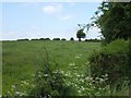
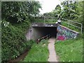
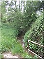
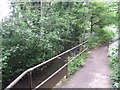
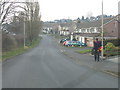
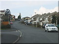
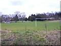
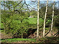
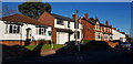
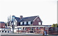
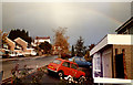
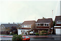
23 photos from this area
Area Information
Key information about the B62 0JL including its size, population, and administrative classification.
- Area Type
- Postcode
- Area Size
- 43.6 hectares
- Population
- 1154
- Population Density
- 66 people/km²
House Prices in B62 0JL
53
Properties
£331,869
Average Sold Price
£83,000
Lowest Price
£750,000
Highest Price
Showing 53 properties
| Address | Type | Beds | Baths | Last Sale Price | Last Sale Date | |
|---|---|---|---|---|---|---|
| 426 Bromsgrove Road, Hunnington, B62 0JL | house | 4 | 2 | £735,000 | Aug 2025 | |
| 369 Bromsgrove Road, Hunnington, B62 0JL | Terraced | 3 | 1 | £335,000 | Jul 2025 | |
| 424 Bromsgrove Road, Hunnington, B62 0JL | Detached | 3 | 1 | £410,000 | Aug 2023 | |
| 454 Bromsgrove Road, Hunnington, B62 0JL | house | 3 | 2 | £527,000 | Mar 2023 | |
| 371 Bromsgrove Road, Hunnington, B62 0JL | house | 3 | 1 | £255,000 | Sep 2022 | |
| 389 Bromsgrove Road, Hunnington, B62 0JL | Terraced | 3 | 1 | £340,000 | Jun 2022 | |
| 420 Bromsgrove Road, Hunnington, B62 0JL | house | - | - | £500,000 | Mar 2022 | |
| 422 Bromsgrove Road, Hunnington, B62 0JL | house | - | - | £525,000 | Nov 2021 | |
| 373 Bromsgrove Road, Hunnington, B62 0JL | Terraced | 3 | 2 | £310,000 | Sep 2021 | |
| 355 Bromsgrove Road, Hunnington, B62 0JL | Semi-detached | 3 | - | £430,000 | Apr 2021 |
Page 1 of 6
Energy Efficiency in B62 0JL
Amenities
Schools
| Rank | School | Type | Entry gender | Ages |
|---|
Explore more schools in this area
Go to Schools tabDemographics
Household Size
Two person
most common
Accommodation Type
Houses
most common
Tenure
87
majority
Ethnic Group
White
most common
Religion
N/A
most common
Household Composition
N/A
most common
Age
47
median
Adults (30-64 years)
most common
Household Deprivation
N/A
with no deprivation
NS-SEC
40
in Lower managerial occupations
Explore more demographic insights in this area
Go to Demographics tabPlanning
Planning Constraints
- Flood RiskPremium
- Ramsar Wetland SitesPremium
- Area of Outstanding Natural BeautyPremium
- Protected Nature ReservePremium
- Protected WoodlandPremium