Area Overview for B62 0FD
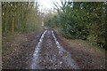
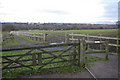
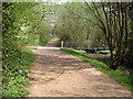
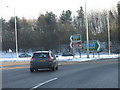
Photos of B62 0FD

Area Information
B62 0FD is a small residential postcode area in Birmingham, England, situated approximately 8 kilometres south-west of the city centre. It falls within the Birmingham Edgbaston parliamentary constituency and is represented by Labour MP Preet Kaur Gill. The area is characterised as a suburban residential cluster with a population of 1446, reflecting a compact, tightly knit community. Historically, Bartley Green—its broader electoral ward—was recorded in the Domesday Book as *Berchelai*, meaning either "birch tree wood" or "clearing in the birch trees." Post-1945, the area saw significant development, including the Athol Farm council estate, though its tower blocks were later demolished. Today, B62 0FD retains a suburban feel with a demographic profile distinct from Birmingham as a whole. The area’s older age profile, with a median age of 47, and its lower proportion of Black, Asian, and Minority Ethnic (BAME) residents compared to the city average, shape its community dynamics. Living here means proximity to amenities like local shops, rail links, and schools, though the area’s 1998 survey highlights urban deprivation, with 52.4% of pupils at Bartley Green School in high-income support dependency. This context underscores the need for buyers to consider both the practicalities and challenges of life in this compact, historically rooted postcode.
- Area Type
- Postcode
- Area Size
- Not available
- Population
- 1446
- Population Density
- 2333 people/km²
B62 0FD is predominantly an owner-occupied area, with 61% of residents owning their homes. The accommodation type is largely houses, reflecting a suburban character that contrasts with Birmingham’s more densely populated zones. This suggests a housing stock that prioritises family-friendly, detached or semi-detached properties, which are likely to be in demand among buyers seeking stability and space. The relatively high home ownership rate indicates a community of long-term residents, though the area’s small size means the property market is limited to a narrow geographic scope. Buyers should consider that the availability of homes may be constrained by the postcode’s compact nature, with limited scope for new developments. The focus on owner-occupied housing also implies that rental options are scarce, potentially limiting flexibility for those seeking short-term accommodation. For those prioritising family living, the prevalence of houses offers practical advantages, though the area’s deprivation indicators suggest that property values may not reflect broader Birmingham trends.
House Prices in B62 0FD
No properties found in this postcode.
Energy Efficiency in B62 0FD
Residents of B62 0FD have access to a range of amenities within practical reach, including retail outlets such as Budgens Woodgate, Co-op Spies, and Tesco Quinton, which provide everyday shopping convenience. The area’s rail links to Rowley Regis, Old Hill, and University stations, alongside metro stops at Edgbaston Village, Kenrick Park, and Handsworth Booth Street, facilitate easy access to Birmingham’s broader urban network. These transport options support both commuting and leisure activities, connecting residents to cultural, educational, and commercial hubs. The presence of Hillcrest School—a noted comprehensive school with a strong academic reputation—adds to the area’s appeal for families. While specific details on parks or recreational spaces are not provided, the proximity to Bartley Reservoir, mentioned in historical records, suggests opportunities for outdoor activities. The combination of local shops, transport links, and educational institutions creates a functional, if modest, lifestyle that balances suburban tranquillity with urban connectivity.
Amenities
Schools
| Rank | School | Type | Entry gender | Ages |
|---|
Explore more schools in this area
Go to Schools tabDemographics
The population of B62 0FD is 1446, with a median age of 47, indicating a community skewed towards adults aged 30–64. Home ownership stands at 61%, with houses being the predominant accommodation type. The majority of residents identify as White, reflecting a lower BAME population share compared to Birmingham as a whole. A 1998 survey revealed that 52.4% of pupils at Bartley Green School lived in areas with high dependency on income support, a figure that highlights the area’s elevated deprivation levels relative to the city average. This suggests that while the area maintains a stable, older demographic, residents may face socioeconomic challenges that impact quality of life. The absence of significant ethnic diversity contrasts with Birmingham’s broader profile, shaping a community with distinct cultural and social characteristics. These figures contextualise the area’s practical realities, from housing affordability to access to services, for prospective buyers considering life in B62 0FD.
Household Size
Accommodation Type
Tenure
Ethnic Group
Religion
Household Composition
Age
Household Deprivation
NS-SEC
Explore more demographic insights in this area
Go to Demographics tabPlanning
Planning Constraints
- Flood RiskPremium
- Ramsar Wetland SitesPremium
- Area of Outstanding Natural BeautyPremium
- Protected Nature ReservePremium
- Protected WoodlandPremium