Area Overview for B61 9DL
Photos of B61 9DL

Area Information
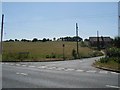
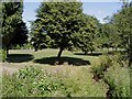
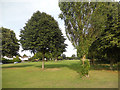
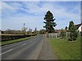
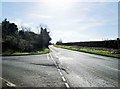
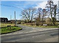
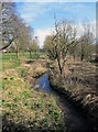
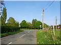
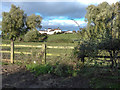
B61 9DL is a small, historic residential cluster nestled in the Bromsgrove district of Worcestershire. With a population of 2,207 and a density of 84 people per square kilometre, it retains a quiet, rural character despite its proximity to urban amenities. The area is part of Dodford with Grafton, a civil parish with roots in the Chartist movement of the 1840s. This village was founded to provide working-class families with small plots for market gardening, a legacy still visible in its narrow lanes, grid street plan, and historic cottages. Today, B61 9DL balances its heritage with modern living, offering low crime rates and easy access to nearby towns. Residents benefit from proximity to Bromsgrove’s rail network and a range of local shops, while the area’s conservation status preserves its architectural and historical integrity. Living here means embracing a slower pace of life, surrounded by listed buildings, ancient woodlands, and a community rooted in agricultural tradition. It is a place where history and practicality coexist, appealing to those seeking stability and a connection to the past.
- Area Type
- Postcode
- Area Size
- Not available
- Population
- 2207
- Population Density
- 84 people/km²
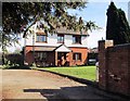
The property market in B61 9DL is dominated by owner-occupied homes, with 85% of properties owned by residents rather than rented. The area’s accommodation is primarily houses, reflecting its rural, low-density character. This contrasts with urban areas where flats and apartments are more common. The high home ownership rate suggests a stable, long-term resident base, with limited turnover in the rental market. For buyers, this means a focus on single-family homes rather than investment properties. The small size of the area and its conservation status may limit new developments, making existing properties more valuable. However, the historic nature of many homes—many built before 1900—could present challenges for modernisation. Buyers should consider the need for maintenance in older properties, though the area’s charm and low crime rates may offset these concerns. The market is likely to cater to those prioritising heritage, privacy, and a slower pace of life over high-density living.
House Prices in B61 9DL
No properties found in this postcode.
Energy Efficiency in B61 9DL
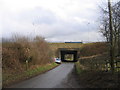
B61 9DL offers a mix of retail and transport amenities within easy reach. The area is served by five retail outlets, including Spar, Waitrose Bromsgrove, and Asda Bromsgrove, providing access to everyday shopping needs. These stores cater to both daily essentials and larger grocery purchases, reducing the need for long trips to larger towns. For transport, five nearby railway stations—Bromsgrove, Barnt Green, and Alvechurch—offer connections to the wider West Midlands rail network. This accessibility supports commuting to nearby cities like Birmingham or Worcester. The area’s historic character also brings a unique lifestyle, with narrow lanes, listed buildings, and remnants of market gardening. Residents benefit from a quiet, low-density environment, where the convenience of local shops and rail links balances with the charm of a preserved rural setting. This combination makes daily life practical yet rooted in tradition.
Amenities
Schools
Residents of B61 9DL have access to two primary schools within practical reach: Dodford First School and Fairfield First School. Both institutions hold a ‘good’ Ofsted rating, indicating a satisfactory standard of education. The presence of two primary schools provides families with options and reduces travel time for children. The schools’ ratings suggest they meet national benchmarks in teaching quality, pupil outcomes, and resource availability. For families with young children, this proximity to education is a significant advantage, reducing reliance on long commutes. The absence of secondary schools in the immediate area may require students to attend institutions in nearby Bromsgrove or Alvechurch, but the primary schools’ performance ensures a strong foundation for early education. The mix of schools reflects the area’s focus on community-based learning and accessibility for local families.
| Rank | School | Type | Entry gender | Ages |
|---|
Explore more schools in this area
Go to Schools tabDemographics
The population of B61 9DL is predominantly adults aged 30–64, with a median age of 47. This suggests a community of established professionals and families, many of whom own their homes—85% of properties are owner-occupied. The area is characterised by houses rather than flats, reflecting a preference for single-family dwellings. The predominant ethnic group is White, though no specific diversity statistics are provided. The low population density of 84 people per square kilometre indicates a spread-out, low-rise settlement pattern. This demographic profile aligns with the area’s historic origins as a planned village for working-class families, many of whom may have remained in the area over generations. The absence of significant deprivation data implies a relatively stable economic environment, though the focus on home ownership and older housing stock suggests limited rental activity. This profile may appeal to buyers seeking long-term stability in a low-density, family-oriented setting.
Household Size
Accommodation Type
Tenure
Ethnic Group
Religion
Household Composition
Age
Household Deprivation
NS-SEC
Explore more demographic insights in this area
Go to Demographics tabPlanning
Planning Constraints
- Flood RiskPremium
- Ramsar Wetland SitesPremium
- Area of Outstanding Natural BeautyPremium
- Protected Nature ReservePremium
- Protected WoodlandPremium