Area Overview for B61 8HG
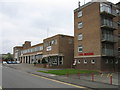
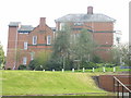
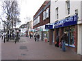
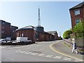
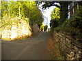
Photos of B61 8HG


Area Information
Living in B61 8HG means being part of a tightly knit residential cluster in England’s West Midlands, where the population of 1,667 reflects a quiet, established community. The area is defined by its proximity to Bromsgrove’s urban core, with Sanders Park—a historic public space gifted by the Sanders family in 1952—serving as a focal point for recreation. This postcode is characterised by its compact layout, blending residential housing with accessible amenities. Daily life here is shaped by the surrounding infrastructure: rail links to Bromsgrove, Barnt Green, and Alvechurch stations provide connectivity, while nearby retail hubs like Asda Bromsgrove and Lidl Bromsgrove cater to everyday needs. The area’s median age of 47 suggests a mature demographic, with many residents likely to be in their prime working years or retired. Its small size means the community feels cohesive, with local landmarks like Sanders Park offering a sense of continuity and shared heritage. For those seeking a balance between convenience and tranquillity, B61 8HG offers a snapshot of suburban England, where historical roots meet modern practicality.
- Area Type
- Postcode
- Area Size
- Not available
- Population
- 1667
- Population Density
- 2809 people/km²
The property market in B61 8HG is shaped by its small size and the predominance of flats. With 51% of homes owned by residents, the area is not heavily skewed toward rental properties, though the high proportion of flats may indicate a greater reliance on leasehold arrangements. This could mean that buyers should consider nearby areas for a broader range of housing options. The compact nature of the postcode limits the availability of larger homes, making it more suited to those seeking smaller, manageable properties. The presence of nearby rail links and retail amenities may enhance the area’s appeal, particularly for commuters or those prioritising convenience over space. However, the limited housing stock means competition for properties could be fierce, and buyers may need to act swiftly. For those interested in long-term ownership, the moderate home ownership rate suggests a balanced market, though the specific impact of flats on property values remains unclear without further data.
House Prices in B61 8HG
No properties found in this postcode.
Energy Efficiency in B61 8HG
The lifestyle in B61 8HG is enhanced by nearby amenities that cater to daily needs and leisure. Retail options include Asda Bromsgrove, Aldi Birmingham, and Lidl Bromsgrove, providing accessible shopping for groceries and household essentials. The proximity to rail stations like Bromsgrove and Barnt Green ensures easy travel for work or socialising. Recreational opportunities are centred around Sanders Park, a historic space featuring sports facilities, a skate park, and a children’s play area. This park, gifted by the Sanders family in 1952, offers a blend of natural and recreational amenities, fostering community interaction. The area’s compact size means amenities are within walking or cycling distance, promoting a convenient, low-stress lifestyle. For residents, the combination of practical retail, accessible transport, and green spaces creates a balanced environment that supports both routine and leisure.
Amenities
Schools
The schools nearest to B61 8HG include North Bromsgrove High School, which operates as both a primary and academy. While the data does not specify Ofsted ratings, the dual role of the school suggests it serves a range of educational needs, from early years to secondary education. This could be beneficial for families requiring a single institution to cover multiple stages of schooling. However, the absence of additional schools in the data means it is unclear whether the area has a comprehensive network of educational options. The presence of a primary and academy may indicate a focus on academic standards, though parents should verify the school’s current performance and capacity. For those prioritising education, the proximity of North Bromsgrove High School is a key consideration, though further research into its curriculum and facilities would be necessary for a complete picture.
| Rank | School | Type | Entry gender | Ages |
|---|
Explore more schools in this area
Go to Schools tabDemographics
The community in B61 8HG is predominantly composed of adults aged 30–64, with a median age of 47. This suggests a mature population, likely with established careers and families. Home ownership accounts for 51% of properties, indicating a mix of owner-occupied and rental homes. The accommodation type is primarily flats, which may reflect a higher proportion of rental properties in the area. The predominant ethnic group is White, though no specific data on diversity or deprivation levels is provided. The age profile implies a stable, long-term resident base, with fewer young families or retirees compared to other areas. This demographic structure may influence local services and amenities, with a focus on adult-oriented needs such as employment, healthcare, and leisure. The lack of data on deprivation means quality of life factors like access to services or economic hardship remain unquantified, though the presence of nearby schools and retail suggests basic needs are met.
Household Size
Accommodation Type
Tenure
Ethnic Group
Religion
Household Composition
Age
Household Deprivation
NS-SEC
Explore more demographic insights in this area
Go to Demographics tabPlanning
Planning Constraints
- Flood RiskPremium
- Ramsar Wetland SitesPremium
- Area of Outstanding Natural BeautyPremium
- Protected Nature ReservePremium
- Protected WoodlandPremium