Area Overview for B61 8ET
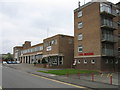
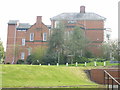
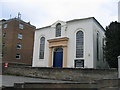
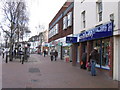
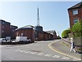
Photos of B61 8ET


Area Information
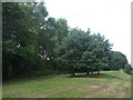
Living in B61 8ET means inhabiting a compact, densely populated residential cluster in England’s West Midlands. The area covers 265 square metres and is home to 1,667 residents, translating to a population density of over six million per square kilometre. This suggests a tightly knit community, though the small size means the area is likely to feel more like a micro-locale than a sprawling suburb. Neighbouring Sanders Park, a public space with recreational facilities, offers a focal point for local activity. The postcode’s proximity to Bromsgrove’s town centre and historical sites like the former cotton mill site adds layers of local identity. While the area’s density might feel intense, its proximity to amenities and transport links could make it appealing for those prioritising convenience over space. The mix of residential housing and nearby green spaces reflects a balance between urban living and access to nature, though the high population density may influence daily life’s pace.
- Area Type
- Postcode
- Area Size
- 265 m²
- Population
- 1667
- Population Density
- 2809 people/km²
The property market in B61 8ET is characterised by a high proportion of flats, with home ownership at 51%. This suggests a mix of owner-occupied and rental properties, though the small area size means the market is likely limited in scope. The predominance of flats may appeal to buyers seeking compact, manageable homes, but it could also restrict options for those preferring larger properties or family homes. Given the area’s density, property values may be influenced by proximity to amenities like Sanders Park and transport links. However, the data does not specify price trends or availability, so buyers should consider the area’s limited footprint when assessing long-term potential. The flat-dominated stock may also mean fewer opportunities for renovations or extensions, which could be a consideration for prospective buyers.
House Prices in B61 8ET
No properties found in this postcode.
Energy Efficiency in B61 8ET
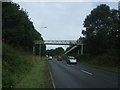
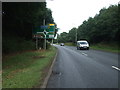
The lifestyle in B61 8ET is shaped by its proximity to Sanders Park, a key recreational hub offering facilities like tennis courts, a skate park, and Cotton Pool. This green space provides opportunities for outdoor activity, walking, and community events, contributing to a balanced daily life. Nearby retail options, including Asda, Aldi, and Lidl, ensure residents have access to essential shopping without long journeys. The rail stations—Bromsgrove, Barnt Green, and Alvechurch—connect the area to broader networks, facilitating travel to work or leisure. However, the data does not mention dining venues or cultural attractions, so the area’s lifestyle appears to prioritise practicality over extensive entertainment options. The combination of green space, retail, and transport links creates a functional environment, though its small size may limit diversity in amenities.
Amenities
Schools
Residents of B61 8ET have access to North Bromsgrove High School, which operates as both a primary school and an academy. This dual role provides a range of educational options for families, though the lack of additional schools in the data means the area’s school landscape is limited to these two institutions. The presence of a primary school suggests the area supports younger families, while the academy designation may indicate a focus on specialist or higher academic standards. However, without Ofsted ratings or performance data, it’s unclear how these schools compare to others in the region. Families relying on these schools may need to consider commuting to other districts for secondary education, as no further schools are listed in the data.
| Rank | School | Type | Entry gender | Ages |
|---|
Explore more schools in this area
Go to Schools tabDemographics
The community in B61 8ET skews towards adults aged 30–64, with a median age of 47. This suggests a stable, mature population, likely with established careers and families. Home ownership sits at 51%, indicating a slight majority of residents own their homes, while the remaining 49% may rent. The accommodation type is predominantly flats, reflecting a housing stock tailored to smaller households or couples. The predominant ethnic group is White, though no specific data on diversity beyond this is provided. With no figures on deprivation or income levels, it’s unclear how economic factors shape quality of life. The age profile implies a community with a strong presence of working-age adults, potentially supporting local services and schools. However, the lack of younger demographics might influence the area’s long-term growth dynamics.
Household Size
Accommodation Type
Tenure
Ethnic Group
Religion
Household Composition
Age
Household Deprivation
NS-SEC
Explore more demographic insights in this area
Go to Demographics tabPlanning
Planning Constraints
- Flood RiskPremium
- Ramsar Wetland SitesPremium
- Area of Outstanding Natural BeautyPremium
- Protected Nature ReservePremium
- Protected WoodlandPremium