Area Overview for B61 8EN
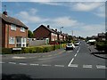
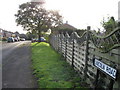
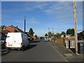
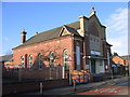
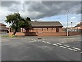
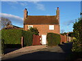
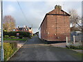
Photos of B61 8EN

Area Information
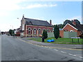
Living in B61 8EN offers a quiet, residential experience within the small cluster of Bromsgrove, Worcestershire. With a population of 1,931, the area is compact but well-connected to nearby amenities. The postcode lies near Sanders Park, a historic public space gifted by the Sanders family in 1952 and opened in 1968. This park, managed by Bromsgrove District Council, features sports facilities, a skate park, and a swimming pool, creating a focal point for local recreation. The area’s proximity to Bromsgrove Town Centre means residents can access shops, services, and transport links without long commutes. The community here is defined by its mix of older housing stock and family-oriented infrastructure, with a median age of 47 suggesting a mature, stable population. While small, B61 8EN is positioned within a region rich in industrial heritage, including historical ties to Bromsgrove’s nail and button industries. Its low crime risk and excellent broadband connectivity make it appealing for those seeking a balance between tranquillity and practicality.
- Area Type
- Postcode
- Area Size
- Not available
- Population
- 1931
- Population Density
- 2815 people/km²
The property market in B61 8EN is dominated by owner-occupied homes, with 67% of properties owned by residents rather than rented. This high home ownership rate suggests a stable market with long-term residents who may be less likely to move frequently. The accommodation type is primarily houses, which contrasts with areas dominated by flats or apartments. This housing stock likely includes semi-detached and detached properties, typical of smaller towns in the West Midlands. For buyers, this means a focus on family-friendly, larger homes rather than investment in rental properties. The small area’s limited size means the immediate surroundings are key to understanding the market, with proximity to Bromsgrove’s town centre and transport links adding value. However, the lack of high-density housing may limit options for those seeking urban living.
House Prices in B61 8EN
No properties found in this postcode.
Energy Efficiency in B61 8EN
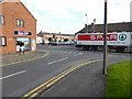
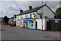
Daily life in B61 8EN is enriched by nearby amenities, including five retail venues such as Spar, Asda Bromsgrove, and Aldi Birmingham, offering convenience for grocery shopping. The area’s proximity to Bromsgrove Town Centre provides additional retail and dining options. Recreational opportunities are centred on Sanders Park, which features sports facilities, a skate park, and a swimming pool, catering to both adults and children. The park’s pedestrian link to the town centre, Spadesbourne Walk, encourages active lifestyles. For leisure, the surrounding area includes historical sites and community events tied to Bromsgrove’s industrial past. These amenities create a mix of practicality and leisure, supporting a balanced lifestyle for residents.
Amenities
Schools
The nearest school to B61 8EN is Sidemoor First School and Nursery, a primary school serving the local community. While no Ofsted rating is provided, its presence indicates a focus on early education for families in the area. The school’s location within practical reach of residents makes it a key factor for parents prioritising proximity to educational facilities. The absence of secondary schools in the immediate vicinity suggests that families may need to travel to nearby towns for further education, though Bromsgrove itself likely offers comprehensive options. The single primary school listed reflects the area’s small size but may limit choices for those seeking multiple educational institutions.
| Rank | School | Type | Entry gender | Ages |
|---|
Explore more schools in this area
Go to Schools tabDemographics
The community in B61 8EN is predominantly composed of adults aged 30–64, with a median age of 47. This suggests a mature population, likely with established careers and family ties. Home ownership is high at 67%, indicating a stable, long-term resident base. The area is characterised by houses rather than flats, reflecting a preference for private, larger properties. The predominant ethnic group is White, though no specific diversity statistics are provided. The absence of detailed data on deprivation means the quality of life must be inferred from other factors, such as low crime rates and access to amenities. The age profile implies a community with a strong presence of working-age individuals and families, which aligns with the availability of local schools and recreational spaces. This demographic structure likely supports a cohesive, low-turnover neighbourhood.
Household Size
Accommodation Type
Tenure
Ethnic Group
Religion
Household Composition
Age
Household Deprivation
NS-SEC
Explore more demographic insights in this area
Go to Demographics tabPlanning
Planning Constraints
- Flood RiskPremium
- Ramsar Wetland SitesPremium
- Area of Outstanding Natural BeautyPremium
- Protected Nature ReservePremium
- Protected WoodlandPremium