Area Overview for B61 7ES
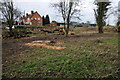
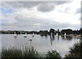
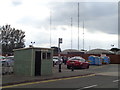
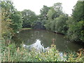
Photos of B61 7ES


Area Information
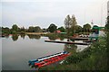
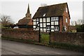
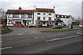
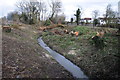
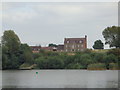
Living in B61 7ES, a small residential cluster in Worcestershire, offers a blend of historical roots and modern convenience. The area covers 4.7 hectares and is home to 1,379 residents, with a population density of 580 people per square kilometre. Situated near Droitwich Spa and bisected by the M5 motorway, this postcode area is part of Dodderhill civil parish, a region with medieval origins and a connection to the River Salwarpe. The community is characterised by a mature demographic, with a median age of 47, and a strong presence of adults aged 30–64. Most residents own their homes, with 67% of properties in private ownership, and the area is predominantly composed of houses rather than flats. Daily life here is shaped by proximity to local amenities, including nearby railway stations and retail outlets, while the area’s historical significance—such as the 13th-century St Augustine’s church—adds a layer of heritage to its modern appeal.
- Area Type
- Postcode
- Area Size
- 4.7 hectares
- Population
- 1379
- Population Density
- 580 people/km²
The property market in B61 7ES is dominated by owner-occupied homes, with 67% of properties in private hands. This indicates a strong presence of long-term residents and a lower proportion of rental properties, which may appeal to buyers seeking stability and investment potential. The area is characterised by houses rather than flats, suggesting a mix of family homes and semi-detached properties. Given the small size of the postcode area—just 4.7 hectares—the housing stock is likely limited, which could make the market competitive for buyers. Proximity to the M5 motorway and nearby railway stations adds to the area’s connectivity, potentially attracting commuters or those seeking easy access to larger towns like Droitwich Spa. However, the small scale of the area means that buyers should consider the broader surrounding regions for more extensive housing options.
House Prices in B61 7ES
Showing 1 properties
| Address | Type | Beds | Baths | Last Sale Price | Last Sale Date | |
|---|---|---|---|---|---|---|
| Hand Car Wash At, Swan Garage, Worcester Road, Upton Warren, B61 7ES | commercial | - | - | - | - |
Energy Efficiency in B61 7ES
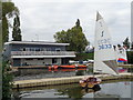
Residents of B61 7ES have access to a range of local amenities within practical reach. The area is served by five retail outlets, including Co-op Bromsgrove, Morrisons Charford, and Aldi Aston, providing everyday shopping needs. Nearby railway stations—Bromsgrove, Droitwich Spa, and Hartlebury—offer easy access to larger towns and services. While the data does not mention parks or leisure facilities, the proximity to the River Salwarpe and historical sites like St Augustine’s church suggests potential for outdoor activities. The combination of retail options and transport links creates a convenient lifestyle, supporting both daily errands and broader regional travel. The small-scale nature of the area means that residents may need to venture slightly further for specialist amenities, but the existing infrastructure ensures a self-contained, functional environment.
Amenities
Schools
The nearest schools to B61 7ES include Wychbold First and Nursery School, which operates as both a primary school and an academy. This dual designation suggests a focus on early education and potentially higher academic standards, though specific Ofsted ratings are not provided. The presence of a primary school within the area is a key consideration for families, offering convenience for young children. However, no secondary schools or further education institutions are listed in the data, meaning students may need to travel to nearby towns for higher-level education. The mix of school types indicates a commitment to foundational learning, but prospective residents should investigate additional educational options beyond primary level to ensure long-term needs are met.
| Rank | School | Type | Entry gender | Ages |
|---|
Explore more schools in this area
Go to Schools tabDemographics
The community in B61 7ES is predominantly composed of adults aged 30–64, with a median age of 47. This suggests a stable, mature population, likely with established careers and family ties to the area. Home ownership is high, with 67% of residents living in properties they own, indicating a sense of permanence. The area is primarily residential, with houses making up the majority of accommodation types, reflecting a suburban or semi-rural character. The predominant ethnic group is White, though no specific data on diversity or deprivation levels is provided. The population density of 580 people per square kilometre suggests a compact, closely knit community, where social interactions and local services are likely to be prominent. This demographic profile implies a focus on family-oriented living, with a balance between professional stability and community engagement.
Household Size
Accommodation Type
Tenure
Ethnic Group
Religion
Household Composition
Age
Household Deprivation
NS-SEC
Explore more demographic insights in this area
Go to Demographics tabPlanning
Planning Constraints
- Flood RiskPremium
- Ramsar Wetland SitesPremium
- Area of Outstanding Natural BeautyPremium
- Protected Nature ReservePremium
- Protected WoodlandPremium